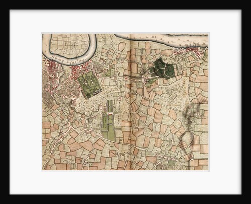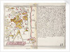

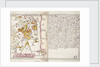
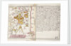
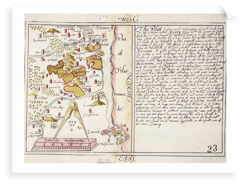
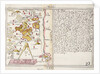
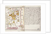
16th century map of county Limerick, Ireland


Sizing information
| Overall size (inc frame) | x cm ( x in) |
| Depth | cm (in) |
| Artwork | x cm ( x in) |
| Border (mount) |
cm
top/bottom
(in)
cm left/right (in) |
| The paper size of our wall art shipped from the US is sized to the nearest inch. | |

16th century map of county Limerick, Ireland
Scale: [ca. 1:126 720 (scale)]. Cartographic Note: North at 90 degrees. Scale in miles. Features large text panel describing parcels of land. From volume eight, Maps of Ireland, of the Dartmouth collection of maps and plans, compiled for or by George Legge, Master General of the Ordnance.
- Image reference: F2044
- National Maritime Museum, Greenwich, London
Discover more
More by this artist
Explore the collection
Search for similar images
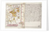
Product images of 16th century map of county Limerick, Ireland


Our prints
We use a 240gsm fine art paper and premium branded inks to create the perfect reproduction.
Our expertise and use of high-quality materials means that our print colours are independently verified to last between 100 and 200 years.
Read more about our fine art prints.
Manufactured in the UK
All products are printed in the UK, using the latest digital presses and a giclée printmaking process.
We only use premium branded inks, and colours are independently verified to last between 100 and 200 years.
Delivery & returns
We print everything to order so delivery times may vary but all unframed prints are despatched within 2-4 days via courier or recorded mail.
Due to the coronovirus pandemic and Brexit situation, current shipping times may be longer, particularly for destinations outside the UK.
Delivery to the UK is £5 for an unframed print of any size.
We will happily replace your order if everything isn’t 100% perfect.