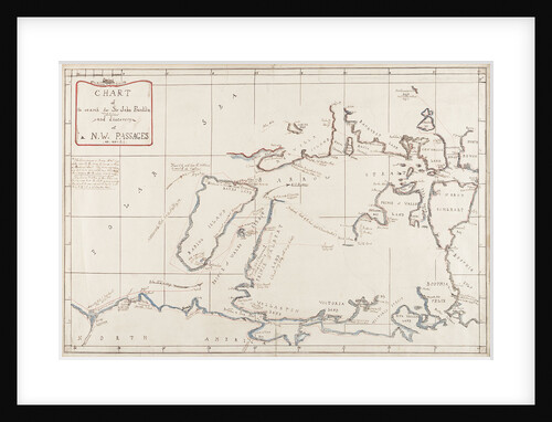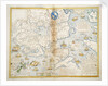

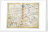

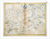
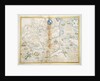
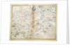
East part of Ulster

Sizing information
| Overall size (inc frame) | x cm ( x in) |
| Depth | cm (in) |
| Artwork | x cm ( x in) |
| Border (mount) |
cm
top/bottom
(in)
cm left/right (in) |
| The paper size of our wall art shipped from the US is sized to the nearest inch. | |

East part of Ulster
This map was drawn to demonstrate to Queen Elizabeth the strategic importance of establishing possession of Strangford Lough and basing the Principal Officer of the Munsters there. Reference is made to Sir John de Courcy's invasion of Ulster from the Isle of Man in the 13th century. Probably drawn after the start of the Nine Years Rebellion (1594-1603).
- Image reference: F2016
- National Maritime Museum, Greenwich, London
Discover more
More by this artist
Explore the collection
Search for similar images
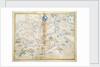
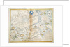
Product images of East part of Ulster


Our framed prints
Every framed picture is created by hand in our workshop by specialist framers.
Black, white, brown, silver, gold or natural frames available, supplied ready to hang.
All our frames have a smooth satin finish, and measure 20mm (front face) by 23mm (depth from wall).
Read more about our framed art prints.
Manufactured in the UK
All products are printed in the UK, using the latest digital presses and a giclée printmaking process.
We only use premium branded inks, and colours are independently verified to last between 100 and 200 years.
Delivery & returns
We print everything to order so delivery times may vary but all framed pictures are despatched within 5-7 days via courier or recorded mail.
Due to the coronovirus pandemic and Brexit situation, current shipping times may be longer, particularly for destinations outside the UK.
Delivery to the UK is £10 for a single framed print.
We will happily replace your order if everything isn’t 100% perfect.