Skip to main content
10% off your first order
☰ Menu
Basket icon
Wishlist icon
Account icon
Search icon
Search icon
Inspiration
Collections
Astrophotography
Battles and wars at sea
Children's
Exploration
Graphic designs
Greenwich
Historic figures
Historic vessels
Maps and charts
Photography
Pirates
Seascapes
Time and space
Natural history
World travel
Ship plans
Gift cards
Contact
Contact us
Newsletter
Search art & photography
Search icon
The Americas
From North to South America, immerse yourself in breathtaking landscapes and seascapes, historic maps and portraits.
Showing 1 to 48 of 199
Featured
A-Z
Z-A
Oldest to newest
Newest to oldest
Bestselling
Products
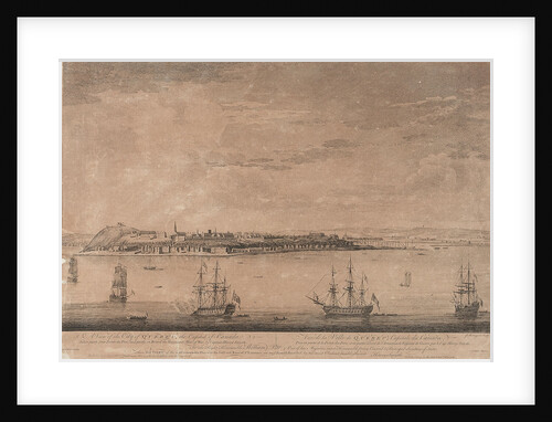
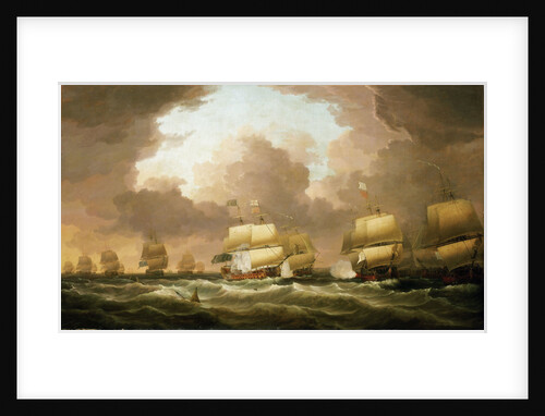
The Battle of Quiberon Bay, 20 November 1759
Nicholas Pocock
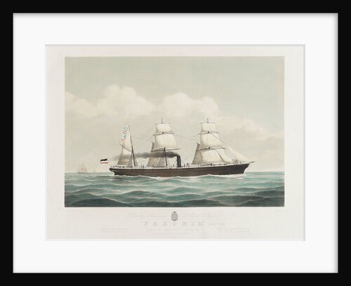
Hamburg American mail steamer 'Saxonia'
H. Petersen
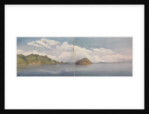
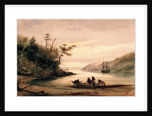
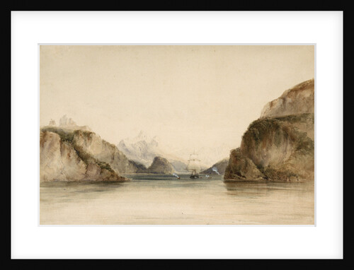
Portrait Cove, Beagle Channel, South America
Conrad Martens
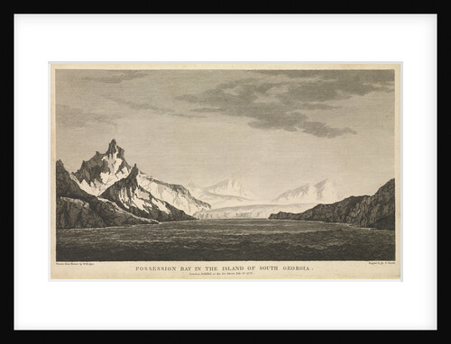
Possession Bay in the island of South Georgia
W Hodges
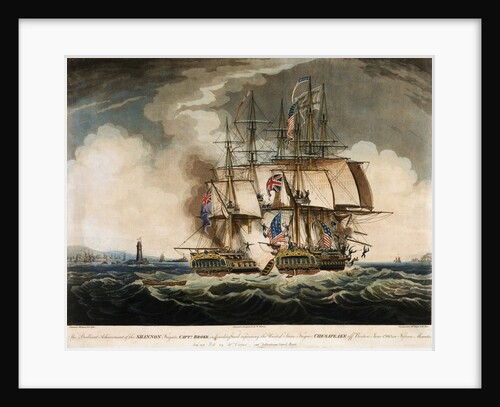
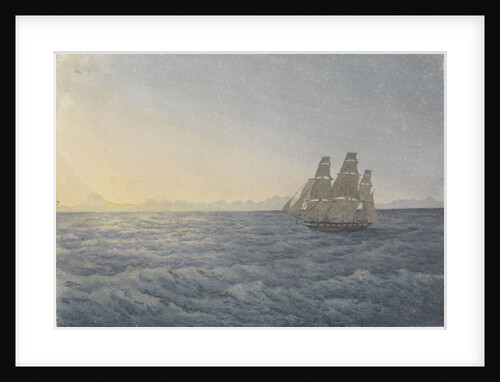
HMS 'Shannon' in battle with the American Frigate 'Chesapeake', 1 June 1813
W. Elmes
Cunard Cruise Line Poster, New York
unknown
Shipping off Saint Helena
Adam Callander
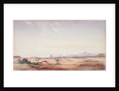
Andes, Aconcagua Peak distant 170 miles, June 18th 1849
Edward Gennys Fanshawe
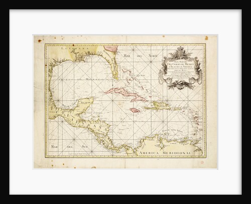
Gulf of Mexico chart by de la Cruz
Thomas Lopez
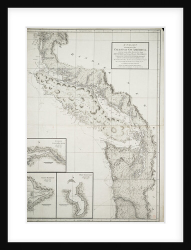
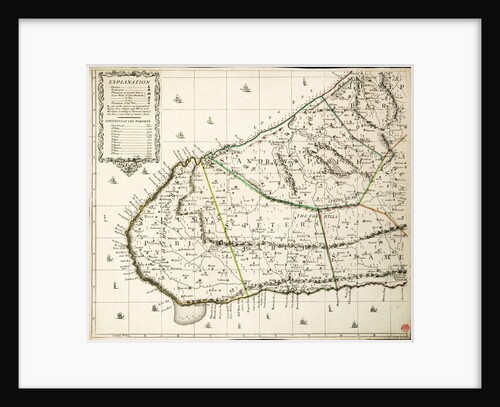
A chart showing part of the coast of north-west America
George Vancouver
Portrait Cove, Beagle Channel, South America
Conrad Martens
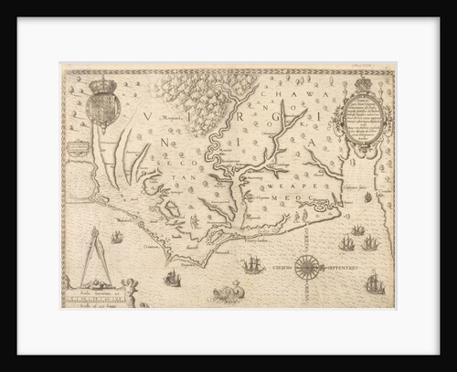
Map of Virginia
unknown
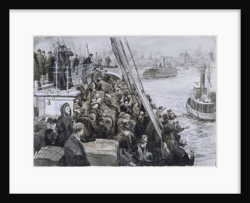
Emigrants, New York
William Lionel Wyllie
HMS 'Daphne' off Cape Horn, 28 May 1852
Edward Gennys Fanshawe
The Port of Veracruz with the Castle of S. Juan de Ulua. Mexico'
M. Rugendas
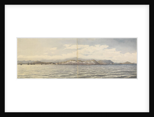
Mazatlan [Mexico] Augt 1850
Edward Gennys Fanshawe
Mexicans, Plaza at Tepic [Mexico], Augt 19th - 13th 1850
Edward Gennys Fanshawe
A new & exact map of the island of Barbados in America according to survey made in the years 1717...
William Mayo
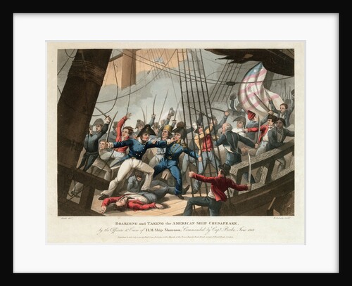
Boarding of the American ship 'Chesapeake' by the crew of HMS 'Shannon', commanded by Captain Broke, June 1813
William Heath
The Wellington Captn James Liddell, off Dover August 12th 1839
William John Huggins
San Francisco, California, Octr 6th 1851
Edward Gennys Fanshawe
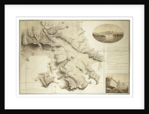
Plan of the environs of English Harbour, Antigua
John Brown
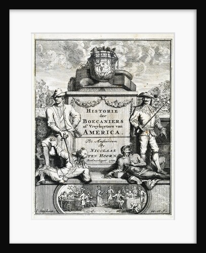
Frontispiece to 'The History of Buccaneers, or Freebooters of America', 1700
unknown
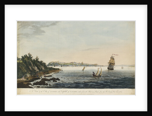
A view of Quebec
Hervey Smyth
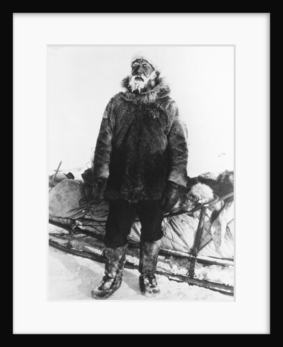
Henry Asbjørn Larsen (1899-1964)
unknown
A view of Quebec
William Peachy
The Battle of Quiberon Bay, 20 November 1759
Richard Paton
The Battle of Quiberon Bay, 20 November 1759
Dominic Serres the Elder
Seascape from the 'Birkdale'
John Everett
Draught of the Island Rattan in the bay of Honduras in latitude 16 degrees 22' north by Lieutenant Henry Barnsley...
Henry Barnsley
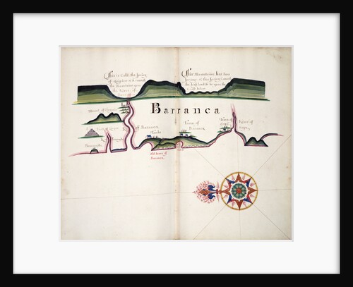
Barranca
William Hack
Captain James Ferguson (1723-1793)
British School
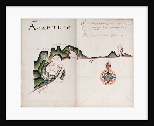
Acapulco
William Hack
A plan of the operations of the King's army under the command of General Sr William Howe KB in New...
Claude Joseph Sauthier
Cordillera of the Andes, as seen from the Mystery Plain, near the Santa Cruz
Conrad Martens
Outer anchorage in a calm, Mazatlan [Mexico], Augt 17th 1850
Edward Gennys Fanshawe
Bay Mazatlan, Mexico
Thomas Somerscales
Outer anchorage in a squall, Mazatlan [Mexico], Augt 22nd 1850, 8.am. ... "Query, which is the way to the ship?'''
Edward Gennys Fanshawe
Plan of the river St. Laurence, Canada, 5 September 1759
Unknown
Rancho at Concon, between Valparaiso and Quillota, Jany 14th 1850 [Chile]
Edward Gennys Fanshawe
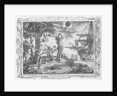
Christopher Columbus's voyage. The Indians astonished at the Eclipse of the Moon foretold by Columbus. Engraved for Drake's Voyages.
unknown
A view of Louisburg in North America, taken from the Light House when that city was beseiged in 1758
unknown
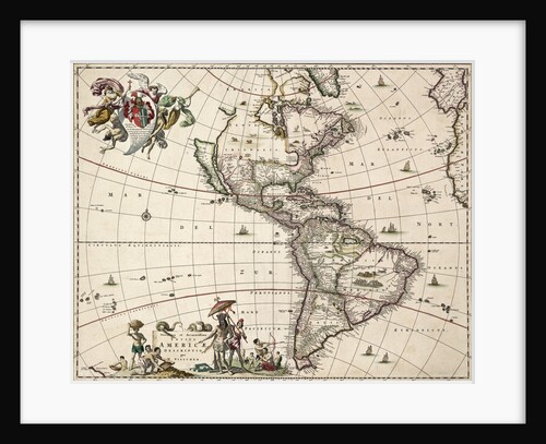
Chart of the Americas
Nikolaus Visscher
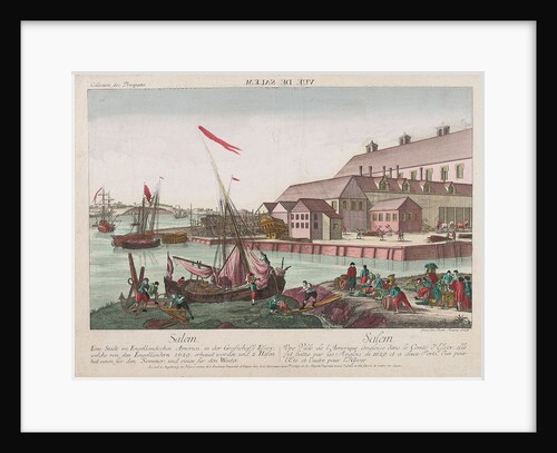
View of Salem, America
Balth Frederic Leizel
Taboga, Bay of Panama - Islands of Perico, Hill over Panama &c in the distance, March 1850
Edward Gennys Fanshawe
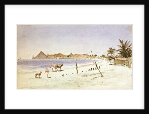
Rio de Janeiro
William Lionel Wyllie
Map of South America
Herman Moll
HMS 'Mediator' engaging French and American vessels, 11-12 December 1782
Thomas Luny
1
2
3
…
5
Next »
Recently viewed
Clear history


![Mazatlan [Mexico] Augt 1850 by Edward Gennys Fanshawe](https://previews.magnoliabox.com/nmm/flat/pz4648/MUS-CFPM-18X24_black_500.jpg)
![Mexicans, Plaza at Tepic [Mexico], Augt 19th - 13th 1850 by Edward Gennys Fanshawe](https://previews.magnoliabox.com/nmm/flat/pz4647/MUS-CFPM-18X24_black_500.jpg)


![Outer anchorage in a calm, Mazatlan [Mexico], Augt 17th 1850 by Edward Gennys Fanshawe](https://previews.magnoliabox.com/nmm/flat/pz4649/MUS-CFPM-16X20_black_500.jpg)
![Outer anchorage in a squall, Mazatlan [Mexico], Augt 22nd 1850, 8.am. ... "Query, which is the way to the ship?''' by Edward Gennys Fanshawe](https://previews.magnoliabox.com/nmm/flat/pz4650/MUS-CFPM-16X20_black_500.jpg)

![Rancho at Concon, between Valparaiso and Quillota, Jany 14th 1850 [Chile] by Edward Gennys Fanshawe](https://previews.magnoliabox.com/nmm/flat/pz4642/MUS-CFPM-16X20_black_500.jpg)