Skip to main content
10% off your first order
☰ Menu
Basket icon
Wishlist icon
Account icon
Search icon
Search icon
Inspiration
Collections
Astrophotography
Battles and wars at sea
Children's
Exploration
Graphic designs
Greenwich
Historic figures
Historic vessels
Maps and charts
Photography
Pirates
Seascapes
Time and space
Natural history
World travel
Ship plans
Gift cards
Contact
Contact us
Newsletter
Search art & photography
Search icon
Home
Collections
The Americas
The Americas
page 4
Showing 145 to 192 of 199
Featured
A-Z
Z-A
Oldest to newest
Newest to oldest
Bestselling
Products
View of Valparaiso, Chile
Harry Edmund Edgell
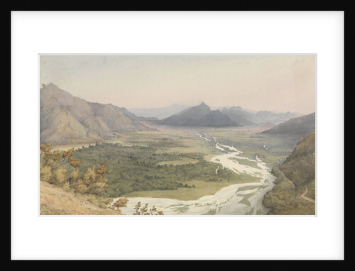
Two Leagues from Santa Rosa [Chile], Jany 14th 1851 [with the Andes and Aconcagua]
Edward Gennys Fanshawe
The Cuesta de Chacabuco, looking towards San Felipe de Aconcagua [Chile], Jany 14th 1851
Edward Gennys Fanshawe
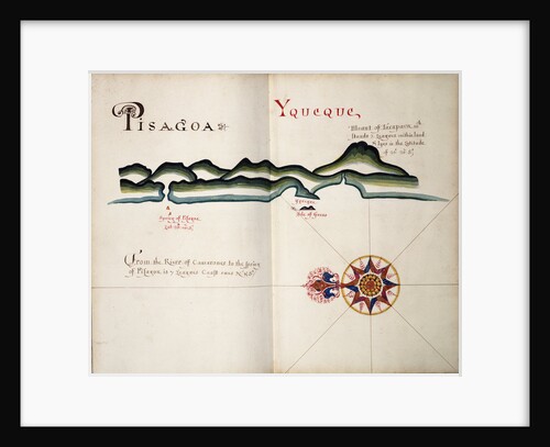
Pisagoa and Yqueque, Chile
William Hack
Suspension Bridge of hide thongs (but repaired with chain) over the Maypu, five leagues south of Santiago, Chile, Jany 11th...
Edward Gennys Fanshawe
New York, United States of America
Marine Photo Service
New York, United States of America
Marine Photo Service
Plain of Santiago, Chile, from the Cuesta del Prado, Jany 7th 1851
Edward Gennys Fanshawe
Sheet from Bleau's 'Atlas of the Americas'
John Blaeu
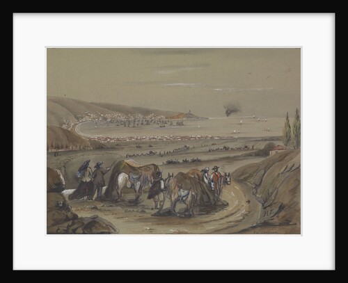
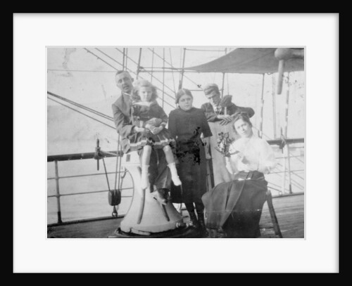
Group portrait including Mr Hill of the Seamen's Institution on deck, at Iquique, Chile
unknown
Lake of Acoleo [Aculeo], Chile, Jany 11th 1851
Edward Gennys Fanshawe
Map of Chile, Patagonia, Tierra del Fuego and the Falkland Islands
Juan de Langara
Iquique, Chile
Basil Ringrose
Conway Harbour and Port Aylesbury, North American Atlantic Coast
J.F.W. Des Barres
Map of Chile compiled by Jesuits, 1646
Society of Jesus
Indians at Fort Rupert, Vancouver's Island, July 1851 [Canada]
Edward Gennys Fanshawe
Fort Rupert, Beaver Harbour, Vancouver's Island, July 23rd 1851 [Canada]
Edward Gennys Fanshawe
Group portrait with Captain H.J. Bray and family, also apprentices (including Owen Lloyd marked with an X) on deck, at...
unknown
Map of Quebec, Canada
Sayer & Bennett
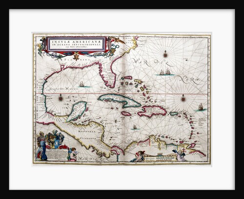
Gulf of Mexico and the Caribbean, from Blaeu's 'Atlas of the Americas'
John Blaeu
Deer Island, Beaver Harbour, Vancouver's Island, July 15th 1851 [Canada]
Edward Gennys Fanshawe
Esquimalt Harbour, Vancouver's Island, June 28th 1851 [Canada]
Edward Gennys Fanshawe
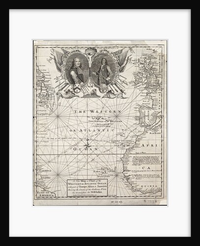
A new map or chart of the western or Atlantic ocean with part of Europe, Africa and America: showing the...
E. Bowen
An American privateer schooner and other vessels near a harbour
Burton
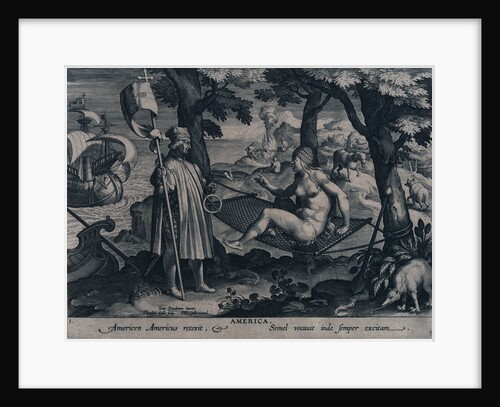
America. Americen Americus retexit, Semel vocauit inde semper exitam
Johannes Stradanus
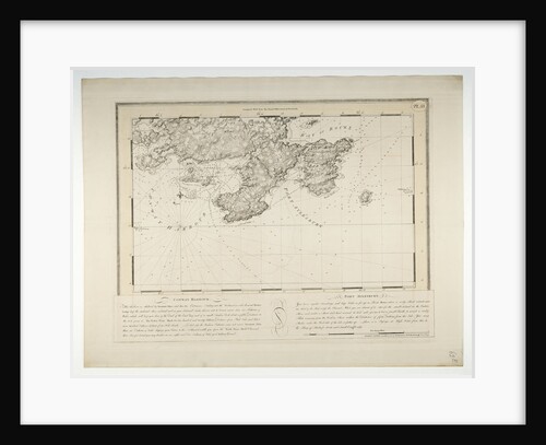
Chart of Ipswich Bay and Cape Ann, Atlantic coast of North America
J.F.W. Des Barres
A map of the British and French dominions in North America
John Mitchell
America. Americen Americus retexit, Semel vocauit inde semper exitam (the astrolabe)
Johannes Stradanus
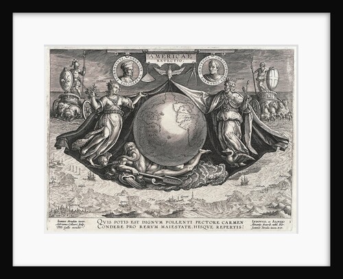
Americae Retectio (The Globe showing America, Africa and Europe and a panorama of Europe also portraits of Christopher Columbus and...
Johannes Stradanus
America'
unknown
American pilot boat
unknown
'Essex Lance' (Br, 1918) at anchor in Bedford Basin, Halifax, Nova Scotia, Canada
unknown
American soldier peeling onions while wearing a gas mask
Alan Villiers
Caribbean and coasts of America
Joan Martines
American corvette
William John Huggins
A new & exact map of the island of Barbados in America according to survey made in the years 1717...
William Mayo
A new & exact map of the island of Barbados in America according to survey made in the years 1717...
William Mayo
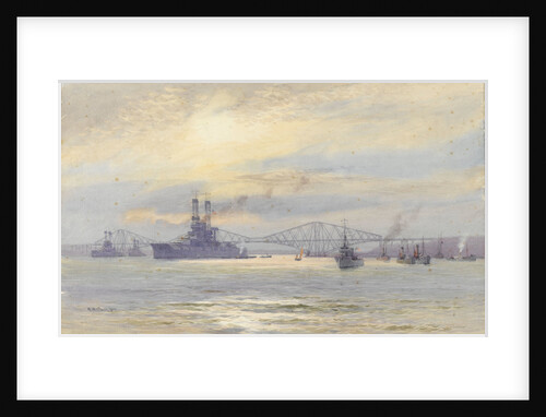
American battleship in the Firth of Forth
Alma Claude Burlton Cull
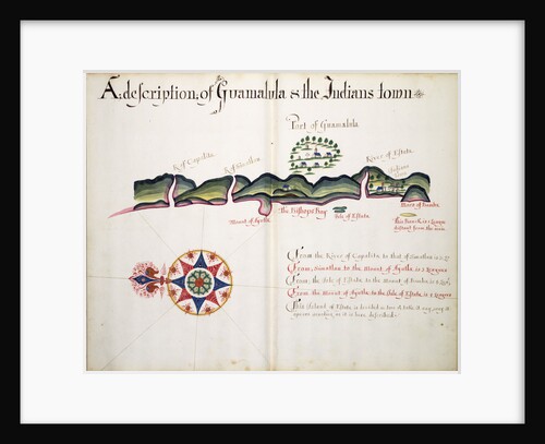
A description of Guamalula & the Indians town
William Hack
An English brig with captured American vessels
Francis Holman
American brig chased by British frigate
William John Huggins
Chart of river of St. Lawrence, North America Atlantic coast
J. F. W. Des Barres
Chart of river Valdivia and surroundings, Chile
Luis de Surville
Chart of Paraguay, Chile, Straits of Magellan and Tierra del Fuego in South America
Nicholas Visscher
A new & exact map of the island of Barbados in America according to survey made in the years 1717...
William Mayo
Between San Felipe de Aconcagua and Quillota, Chile, Jany 16th 1851
Edward Gennys Fanshawe
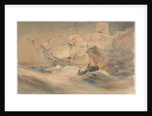
600 lives rescued from the 'Connaught' by the American ship 'Minnie Shiffe'r in the Atlantic, 8 October 1860
Oswald Walter Brierly
Chart of Ipswich Bay and Cape Ann, Atlantic coast of North America
J.F.W. Des Barres
« Previous
1
2
3
4
5
Next »
Recently viewed
Clear history
![Two Leagues from Santa Rosa [Chile], Jany 14th 1851 [with the Andes and Aconcagua] by Edward Gennys Fanshawe](https://previews.magnoliabox.com/nmm/flat/pz4658/MUS-CFPM-18X24_black_500.jpg)
![The Cuesta de Chacabuco, looking towards San Felipe de Aconcagua [Chile], Jany 14th 1851 by Edward Gennys Fanshawe](https://previews.magnoliabox.com/nmm/flat/pz4657/MUS-CFPM-18X24_black_500.jpg)


![Lake of Acoleo [Aculeo], Chile, Jany 11th 1851 by Edward Gennys Fanshawe](https://previews.magnoliabox.com/nmm/flat/pz4655/MUS-CFPM-18X24_black_500.jpg)


![Indians at Fort Rupert, Vancouver's Island, July 1851 [Canada] by Edward Gennys Fanshawe](https://previews.magnoliabox.com/nmm/flat/pz4661/MUS-CFPM-16X20_black_500.jpg)
![Fort Rupert, Beaver Harbour, Vancouver's Island, July 23rd 1851 [Canada] by Edward Gennys Fanshawe](https://previews.magnoliabox.com/nmm/flat/pz4664/MUS-CFPM-18X24_black_500.jpg)


![Deer Island, Beaver Harbour, Vancouver's Island, July 15th 1851 [Canada] by Edward Gennys Fanshawe](https://previews.magnoliabox.com/nmm/flat/pz4663/MUS-CFPM-18X24_black_500.jpg)
![Esquimalt Harbour, Vancouver's Island, June 28th 1851 [Canada] by Edward Gennys Fanshawe](https://previews.magnoliabox.com/nmm/flat/pz4660/MUS-CFPM-18X24_black_500.jpg)