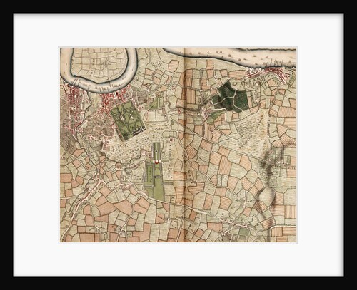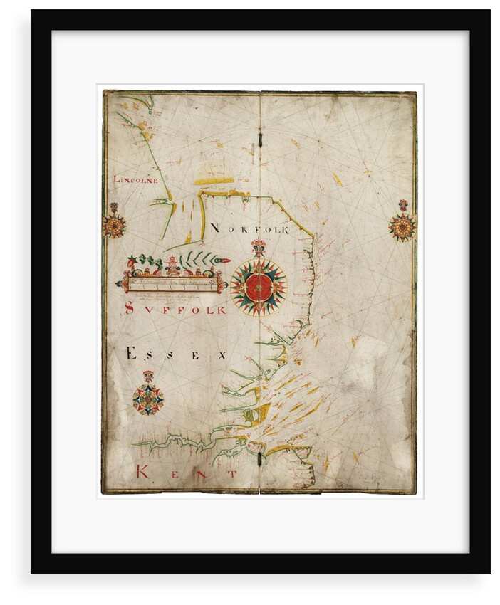
England, east coast, Spurn Head to South Foreland


Image information
Sizing information
| Overall size (inc frame) | x cm ( x in) |
| Depth | cm (in) |
| Artwork | x cm ( x in) |
| Border (mount) |
cm
top/bottom
(in)
cm left/right (in) |
| The paper size of our wall art shipped from the US is sized to the nearest inch. | |

England, east coast, Spurn Head to South Foreland
A chart drawn on vellum and mounted on two hinged oak boards. Scale circa 1:400,000, in miles. The chart has no latitude graduation, shows sand banks and many soundings.
Made by John Thornton dwelling in East Smithfield near Tower Hill. John Thornton was a Thames School chart maker, apprenticed to John Burston in 1656. Later in his career he produced important printed charts.
John Thornton
Original size: 690 mm x 540 mm
- Image reference: K0962
- National Maritime Museum, Greenwich, London
Discover more
More by this artist
Explore the collection
Search for similar images
Product images of England, east coast, Spurn Head to South Foreland


Our framed prints
Every framed picture is created by hand in our workshop by specialist framers.
Black, white, brown, silver, gold or natural frames available, supplied ready to hang.
All our frames have a smooth satin finish, and measure 20mm (front face) by 23mm (depth from wall).
Read more about our framed art prints.
Manufactured in the UK
All products are printed in the UK, using the latest digital presses and a giclée printmaking process.
We only use premium branded inks, and colours are independently verified to last between 100 and 200 years.
Delivery & returns
We print everything to order so delivery times may vary but all framed pictures are despatched within 5-7 days via courier or recorded mail.
Due to the coronovirus pandemic and Brexit situation, current shipping times may be longer, particularly for destinations outside the UK.
Delivery to the UK is £10 for a single framed print.
We will happily replace your order if everything isn’t 100% perfect.