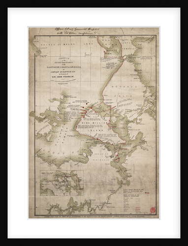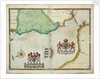
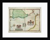
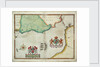
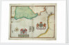
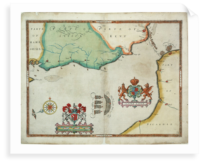
Map of 'The pursuit to Calais, 4 - 6 August 1588'
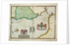
Image information
Sizing information
| Overall size (inc frame) | x cm ( x in) |
| Depth | cm (in) |
| Artwork | x cm ( x in) |
| Border (mount) |
cm
top/bottom
(in)
cm left/right (in) |
| The paper size of our wall art shipped from the US is sized to the nearest inch. | |

Map of 'The pursuit to Calais, 4 - 6 August 1588'
Disbound sheet. Hand coloured engraving. Scale: circa 1:400,000 (bar). Ungraduated chart of the track of the Spanish Armada. The bar scale is in English miles. The chart contains the coats of arms of Queen Elizabeth and Lord Howard. The prevailing wind direction is indicated next to the compass rose.
Object number: PBD8529(10)
Date: 1590
Original dimensions: 430 mm x 535 mm
- Image reference: F8046
- National Maritime Museum, Greenwich, London
Discover more
More by this artist
Robert Adams; Augustine Ryther
Explore the collection
Search for similar images
Product images of Map of 'The pursuit to Calais, 4 - 6 August 1588'


Our prints
We use a 240gsm fine art paper and premium branded inks to create the perfect reproduction.
Our expertise and use of high-quality materials means that our print colours are independently verified to last between 100 and 200 years.
Read more about our fine art prints.
Manufactured in the UK
All products are printed in the UK, using the latest digital presses and a giclée printmaking process.
We only use premium branded inks, and colours are independently verified to last between 100 and 200 years.
Delivery & returns
We print everything to order so delivery times may vary but all unframed prints are despatched within 2-4 days via courier or recorded mail.
Due to the coronovirus pandemic and Brexit situation, current shipping times may be longer, particularly for destinations outside the UK.
Delivery to the UK is £5 for an unframed print of any size.
We will happily replace your order if everything isn’t 100% perfect.