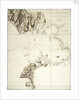

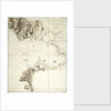
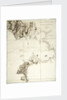
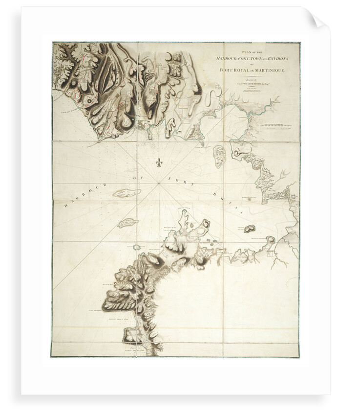
Plan of the harbour, fort, town and environs of Fort Royal in Martinique
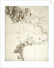
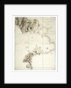
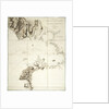
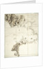
Image information
Sizing information
| Overall size (inc frame) | x cm ( x in) |
| Depth | cm (in) |
| Artwork | x cm ( x in) |
| Border (mount) |
cm
top/bottom
(in)
cm left/right (in) |
| The paper size of our wall art shipped from the US is sized to the nearest inch. | |

Plan of the harbour, fort, town and environs of Fort Royal in Martinique
The chart shows where the British Army and Barbados Volunteers landed in 1762 and the siege positions. In January 1762, British forces landed and besieged Fort Royal then took control of the island. It was returned to the French in the Treaty of Paris in 1763. In 1794, the year after this chart was published, the British captured Martinique again. Booth was a Lieutenant in the Royal Engineers.
William Booth
Original size: 880 mm x 700 mm
- Image reference: K0893
- National Maritime Museum, Greenwich, London
Discover more
More by this artist
Explore the collection
Search for similar images
Product images of Plan of the harbour, fort, town and environs of Fort Royal in Martinique


Our prints
We use a 240gsm fine art paper and premium branded inks to create the perfect reproduction.
Our expertise and use of high-quality materials means that our print colours are independently verified to last between 100 and 200 years.
Read more about our fine art prints.
Manufactured in the UK
All products are printed in the UK, using the latest digital presses and a giclée printmaking process.
We only use premium branded inks, and colours are independently verified to last between 100 and 200 years.
Delivery & returns
We print everything to order so delivery times may vary but all unframed prints are despatched within 2-4 days via courier or recorded mail.
Due to the coronovirus pandemic and Brexit situation, current shipping times may be longer, particularly for destinations outside the UK.
Delivery to the UK is £5 for an unframed print of any size.
We will happily replace your order if everything isn’t 100% perfect.