Skip to main content
10% off your first order
☰ Menu
Basket icon
Wishlist icon
Account icon
Search icon
Search icon
Inspiration
Collections
Astrophotography
Battles and wars at sea
Children's
Exploration
Graphic designs
Greenwich
Historic figures
Historic vessels
Maps and charts
Photography
Pirates
Seascapes
Time and space
Natural history
World travel
Ship plans
Gift cards
Contact
Contact us
Newsletter
Search art & photography
Search icon
Early to mid 16th century prints
Showing 1 to 48 of 351
Search these images +
Search Early to mid 16th century images
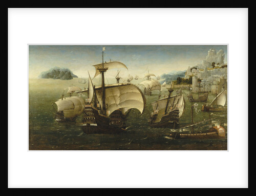
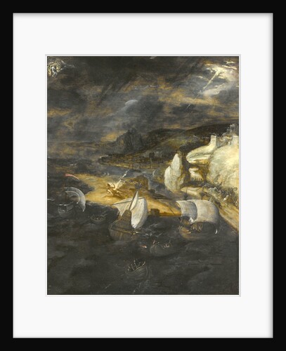
Portuguese carracks off a rocky coast
Joachim Patinir
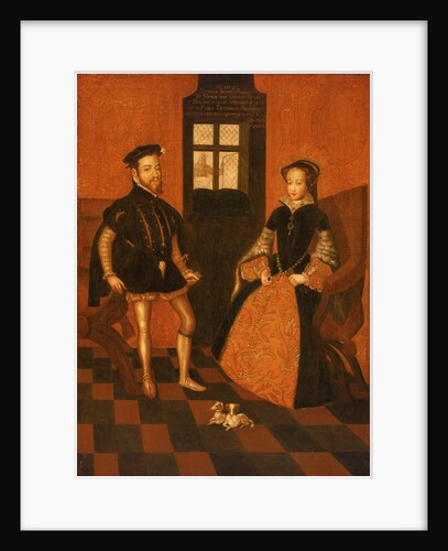
Mary I of England (1516-58) and Philip II of Spain (1527-98)
English School
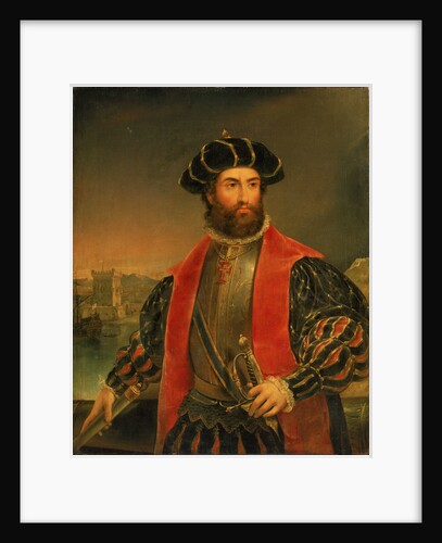
Vasco da Gama (circa 1460-1524)
Antonio Manuel da Fonseca
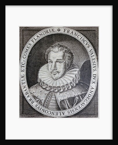
Francis, Duke of Anjou
Unknown
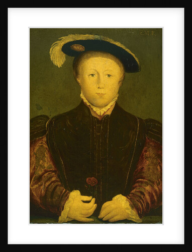
Edward VI (1537-1553)
Hans Holbein
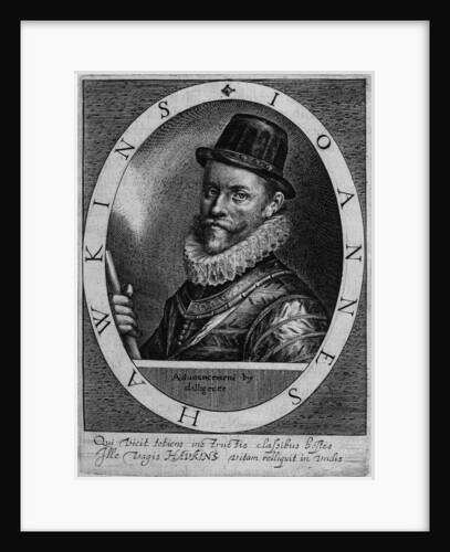
Admiral Sir John Hawkins (1532-1595)
Willem van de Pass(e)
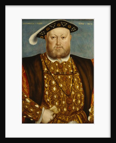
Henry VIII (1491-1547)
Unknown
Map of the Congo Kingdom 1578
unknown
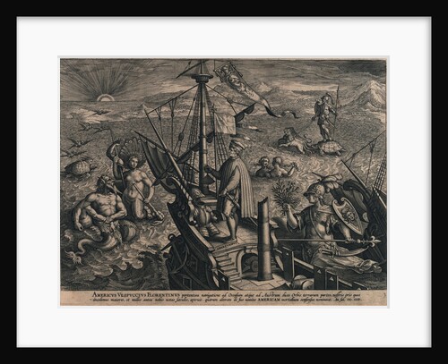
Americus Vespuccius Florentinus portentosa navigatione ad Occasum... (Voyage of Vespucci)
Unknown
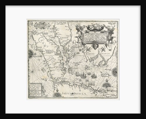
Linschoten's voyage to the East Indies, 1583-1595
unknown
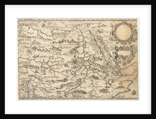
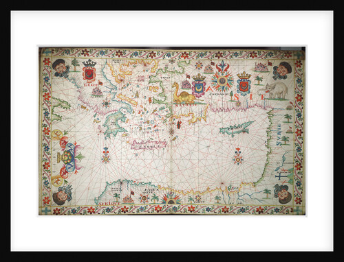
Chart of the eastern Mediterrean
unknown
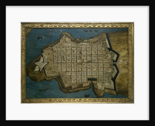
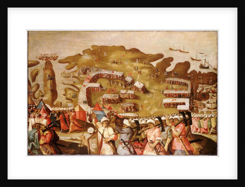
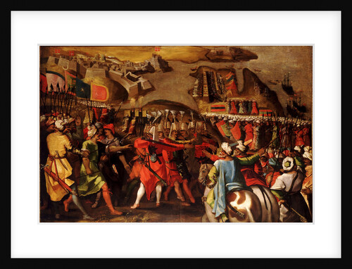
The Siege of Malta: Valetta, 13 September 1565
Matteo Perez d'Aleccio
The Siege of Malta: Arrival of the Turkish Fleet, 20 May 1565
Matteo Perez d'Aleccio
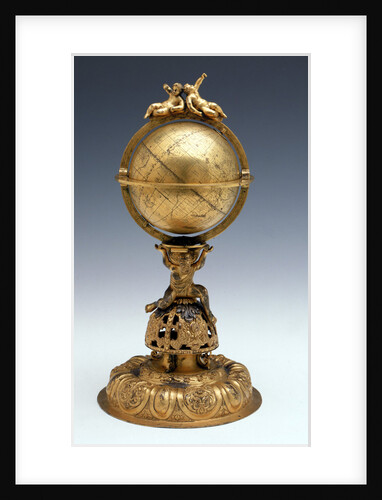
Sphere and stand
unknown
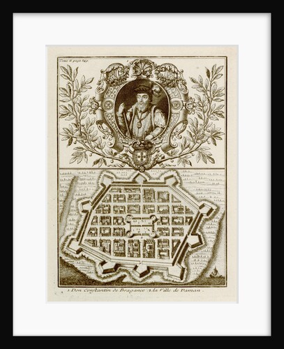
Don Constantin de Bragance
unknown
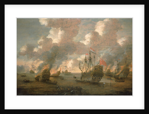
Dutch Attack on the Medway, 9-14 June 1667
Pieter van den Velde
An English ship in action with Barbary Corsairs, circa 1680
Willem Van de Velde the Younger
The fall of Lucifer
Herri met den Bles
Early 17th century map of the world, after Mercator, with inset portraits of explorers (Drake, Magellan, Thomas Cavendish and Oliver...
unknown
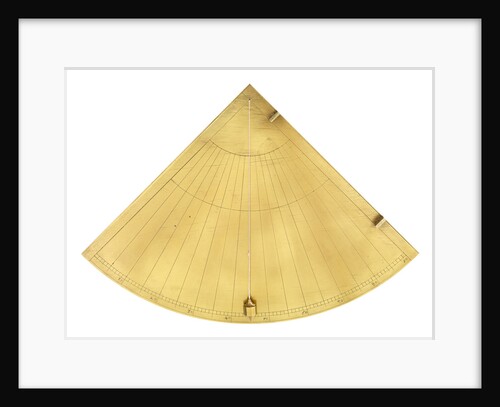
Mariner's quadrant, circa 1600
unknown
The Siege of Malta:Turkish bombardment of Birgu, 6 July 1565
Matteo Perez d'Aleccio
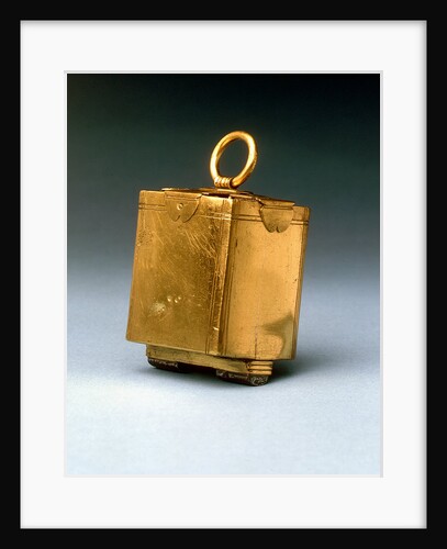
Lodestone, circa 1600
unknown
Lands End to Start Point: The arrival of the Spanish Armada off Cornwall
Robert Adams
'Golden Lion' commanded by Henry Seymour
Claes Jansz Visscher the Younger
Vavassore chart of the Mediterranean Sea, believed to be the earliest surviving printed chart, 1541
Giovanni Andrea Di Vavassore
Map of 'The pursuit to Calais, 4 - 6 August 1588'
Robert Adams; Augustine Ryther
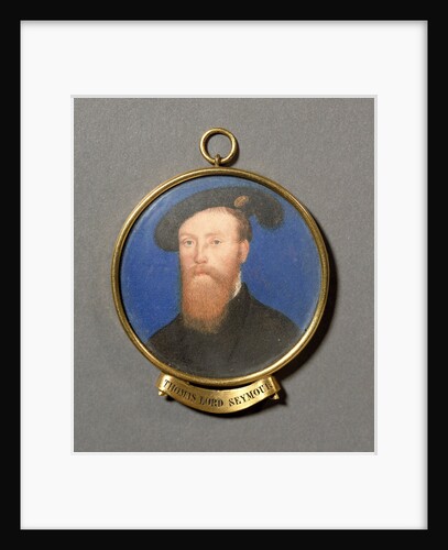
Thomas Seymour, Lord Seymour of Sudeley (circa 1508-1549)
unknown
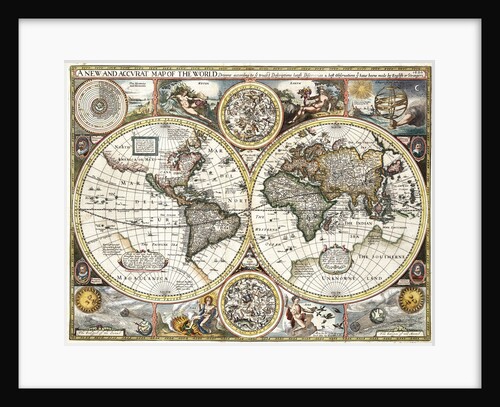
'A new and accurate map of the world' by John Speed, 1626
John Speed
Anne of Denmark, 1574
John de Critz
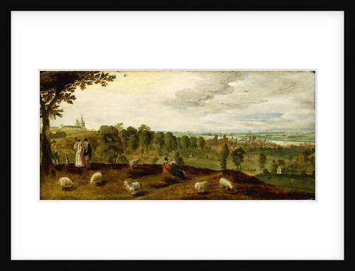
Greenwich from the park showing the Tudor palace, circa 1620
Unknown
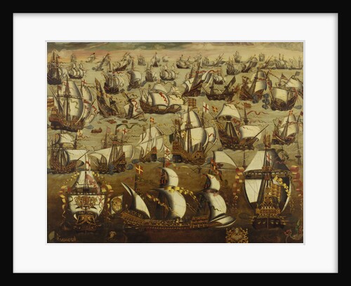
English ships and the Spanish Armada, August 1588
English School
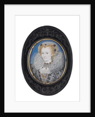
Unidentified lady
Isaac Oliver
The Siege of Malta: Assault on the post of the Castilian knights, 21 August 1565
Matteo Perez d'Aleccio
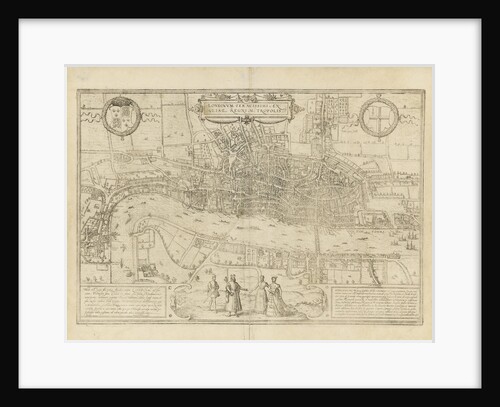
Map of London
unknown
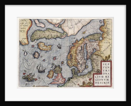
Map of Europe by Ortelius, 16th century
Abraham Ortelius
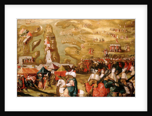
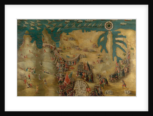
The Siege of Malta: Siege and bombardment of Saint Elmo, 27 May 1565
Matteo Perez d'Aleccio
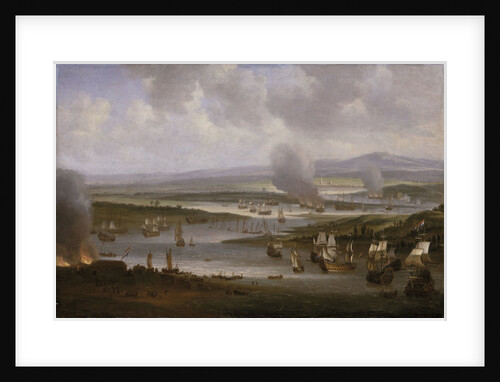
Dutch ships in the Medway, June 1667
Willem Schellinks
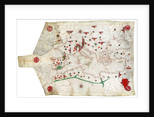
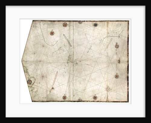
Portulan chart of Mediterranean Sea and NE Atlantic, this is the oldest portulan in the National Maritime Museum's collections
Jacopo Bertran
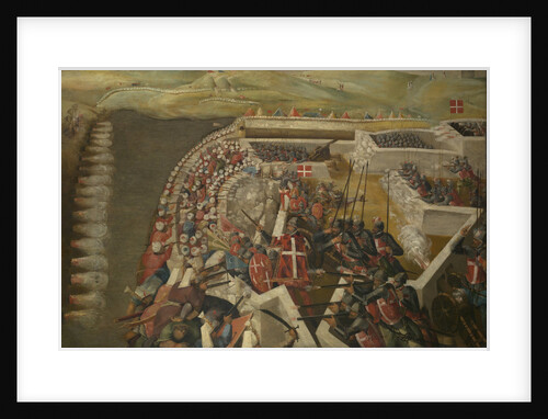
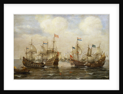
An engagement between the Spanish and the Dutch, circa 1630
Cornelisz Verbeecq
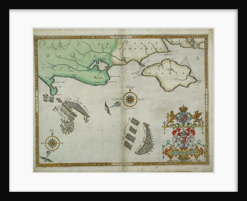
Portland Bill to Portsmouth: The pursuit of the Spanish Armada by the English Fleet
Robert Adams
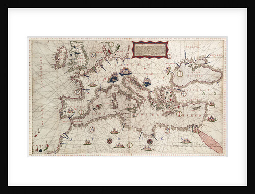
Chart of the Mediterranean circa 1640
Joan Oliva
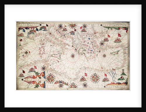
Chart of Mediterranean, Black and Caspian Seas, 16th century
Paulo Forlani
Portulan chart constructed by William Borough showing the sea area of the North Sea and Baltic, from the east coast...
William Borough
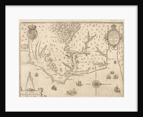
Map of Virginia
unknown
View of Surat, circa 1660
unknown
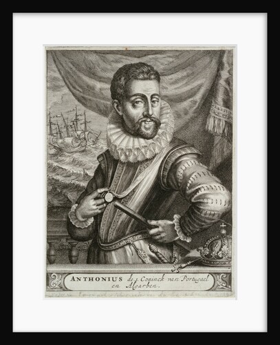
Dom Antonio, Prior of Crato (1531-1595)
unknown
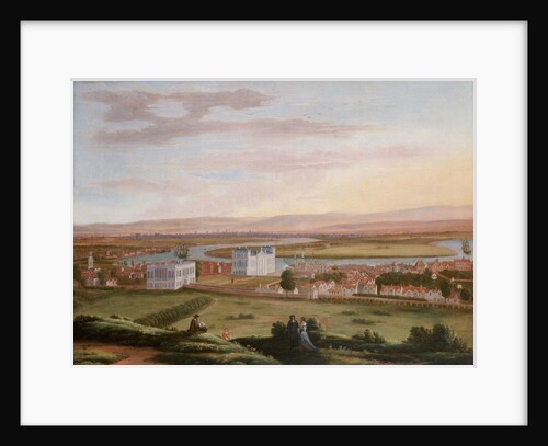
A view of Greenwich and the Queen's House from the South East, circa 1670
Hendrick Danckerts
The Siege of Malta: Flight of the Turks, 13 September 1565
Matteo Perez d'Aleccio
1
2
3
…
8
Next »
Recently viewed
Clear history