Skip to main content
10% off your first order
☰ Menu
Basket icon
Wishlist icon
Account icon
Search icon
Search icon
Inspiration
Collections
Astrophotography
Battles and wars at sea
Children's
Exploration
Graphic designs
Greenwich
Historic figures
Historic vessels
Maps and charts
Photography
Pirates
Seascapes
Time and space
Natural history
World travel
Ship plans
Gift cards
Contact
Contact us
Newsletter
Search art & photography
Search icon
Gren80a/1 prints
Showing 1 to 3 of 3
Search these images +
Search Gren80a/1 images
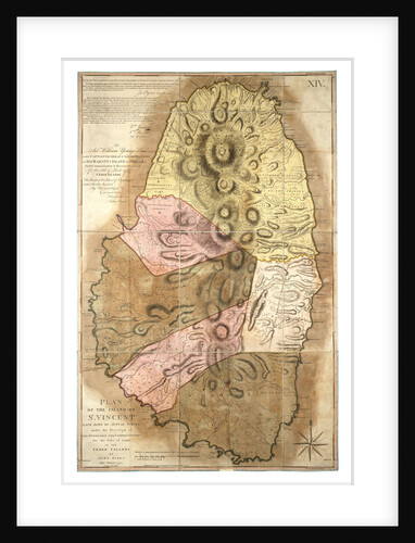
Plan of the Island of St Vincent laid down by actual survey, 1776
John Byres
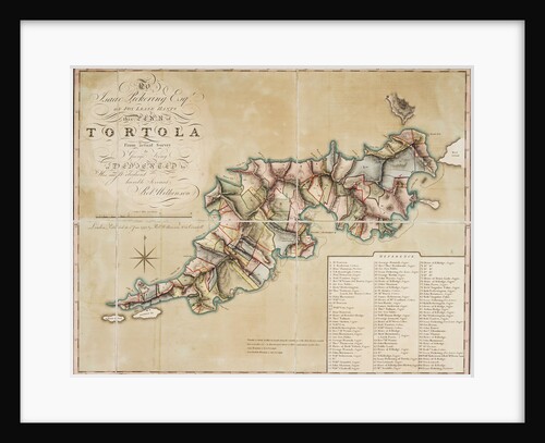
Plan of Tortola from survey by George King
George King
A map of a part of Yucatan or of that part of the eastern shore within the Bay of Honduras...
William Faden
Recently viewed
Clear history
![A map of a part of Yucatan or of that part of the eastern shore within the Bay of Honduras alloted [sic] to Great Britain for the cutting of logwood, in consequence of the convention signed with Spain on the 14th July 1786. By a Bay Man. by William Faden](https://previews.magnoliabox.com/nmm/flat/k0919/MUS-CFPM-18X24_black_500.jpg)