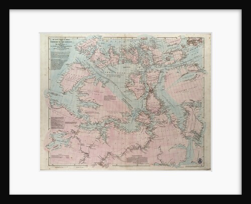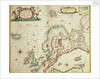

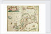
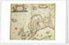
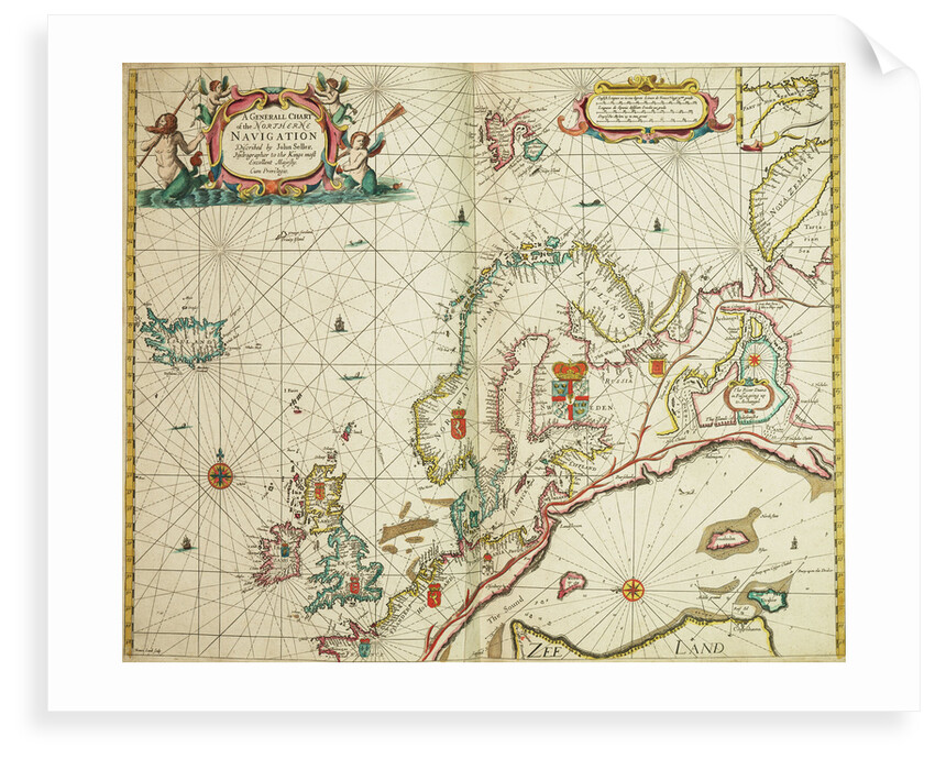
A general chart of the northern navigation
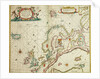
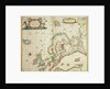
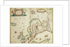
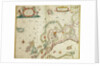
Image information
Sizing information
| Overall size (inc frame) | x cm ( x in) |
| Depth | cm (in) |
| Artwork | x cm ( x in) |
| Border (mount) |
cm
top/bottom
(in)
cm left/right (in) |
| The paper size of our wall art shipped from the US is sized to the nearest inch. | |

A general chart of the northern navigation
Scale: [ca. 1:9 000 000 (bar)]. Cartographic Note: Borders graduated for latitude. Bar scales in English and French leagues, Spanish leagues and Dutch miles. Additional Places: Northern Europe, Iceland, Greenland, Novaya Zemlya. Contents Note: There is a continuation of Nova Zemla inset at the same scale at the top right. There are two other insets at different, unstated, scales, separated by decorative tendrils: The River Dvina in Russia going up to Archangel [N at 226 degrees]; and The Sound [N at 272 degrees].
John Seller
- Image reference: F8056
- National Maritime Museum, Greenwich, London
Discover more
More by this artist
Explore the collection
Search for similar images
Product images of A general chart of the northern navigation


Our prints
We use a 240gsm fine art paper and premium branded inks to create the perfect reproduction.
Our expertise and use of high-quality materials means that our print colours are independently verified to last between 100 and 200 years.
Read more about our fine art prints.
Manufactured in the UK
All products are printed in the UK, using the latest digital presses and a giclée printmaking process.
We only use premium branded inks, and colours are independently verified to last between 100 and 200 years.
Delivery & returns
We print everything to order so delivery times may vary but all unframed prints are despatched within 2-4 days via courier or recorded mail.
Due to the coronovirus pandemic and Brexit situation, current shipping times may be longer, particularly for destinations outside the UK.
Delivery to the UK is £5 for an unframed print of any size.
We will happily replace your order if everything isn’t 100% perfect.