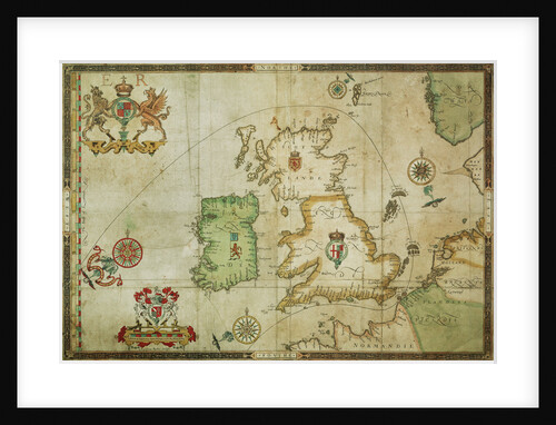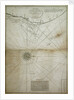
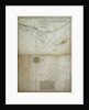
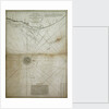
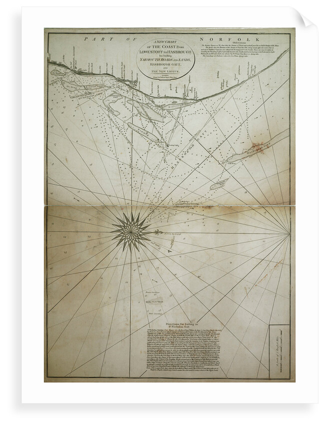
A new chart of the coast from Lowestoff to Hasbrough including Yarmouth Roads and Sands, Hasbrough Gatt, and the new lights

Image information
Sizing information
| Overall size (inc frame) | x cm ( x in) |
| Depth | cm (in) |
| Artwork | x cm ( x in) |
| Border (mount) |
cm
top/bottom
(in)
cm left/right (in) |
| The paper size of our wall art shipped from the US is sized to the nearest inch. | |

A new chart of the coast from Lowestoff to Hasbrough including Yarmouth Roads and Sands, Hasbrough Gatt, and the new lights
Bar scale in miles. North at 90 degrees (magnetic). Variation given as 25 degrees east in 1790. Contents Note: Contains sailing directions and observations.
Object number: DIS01(5)
Original size: 730 mm x 515 mm
Date: 1797
- Image reference: F8053
- National Maritime Museum, Greenwich, London
Discover more
More by this artist
Explore the collection
Search for similar images
Product images of A new chart of the coast from Lowestoff to Hasbrough including Yarmouth Roads and Sands, Hasbrough Gatt, and the new lights


Our prints
We use a 240gsm fine art paper and premium branded inks to create the perfect reproduction.
Our expertise and use of high-quality materials means that our print colours are independently verified to last between 100 and 200 years.
Read more about our fine art prints.
Manufactured in the UK
All products are printed in the UK, using the latest digital presses and a giclée printmaking process.
We only use premium branded inks, and colours are independently verified to last between 100 and 200 years.
Delivery & returns
We print everything to order so delivery times may vary but all unframed prints are despatched within 2-4 days via courier or recorded mail.
Due to the coronovirus pandemic and Brexit situation, current shipping times may be longer, particularly for destinations outside the UK.
Delivery to the UK is £5 for an unframed print of any size.
We will happily replace your order if everything isn’t 100% perfect.