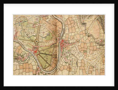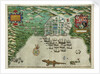

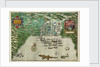

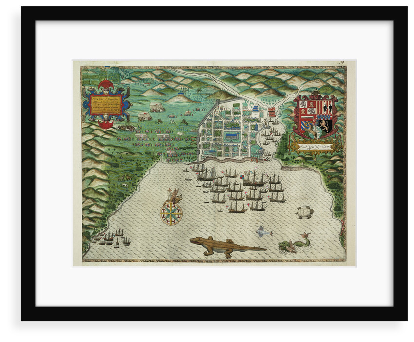
Map of Santo Domingo

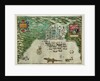
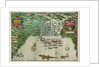
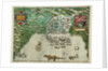
Image information
Sizing information
| Overall size (inc frame) | x cm ( x in) |
| Depth | cm (in) |
| Artwork | x cm ( x in) |
| Border (mount) |
cm
top/bottom
(in)
cm left/right (in) |
| The paper size of our wall art shipped from the US is sized to the nearest inch. | |

Map of Santo Domingo
Scale: ca. 1:5 000. Map showing Santo Domingo with features and incidents of Drake's attack on the town. The sea area is decorated with local wildlife including a crocodile, a flying fish and a turtle. this is one of four charts drawn to accompany Walter Bigges' Expeditio Francisci Draki, published in 1588.
Latin inscription: 'Civitas S Dominici sita in Hispaniola Indiea Angliae magnitudinae ferre aequalis, ipsa urbs elagantur ab Hispanis extracta, et omnibus circumvicinis insulis iura dat'.
Size: 420 mm x 570 mm
Object Number: PBC4053(2)
Date: 1588
- Image reference: F8033
- National Maritime Museum, Greenwich, London
Discover more
More by this artist
Explore the collection
Search for similar images
Product images of Map of Santo Domingo


Our framed prints
Every framed picture is created by hand in our workshop by specialist framers.
Black, white, brown, silver, gold or natural frames available, supplied ready to hang.
All our frames have a smooth satin finish, and measure 20mm (front face) by 23mm (depth from wall).
Read more about our framed art prints.
Manufactured in the UK
All products are printed in the UK, using the latest digital presses and a giclée printmaking process.
We only use premium branded inks, and colours are independently verified to last between 100 and 200 years.
Delivery & returns
We print everything to order so delivery times may vary but all framed pictures are despatched within 5-7 days via courier or recorded mail.
Due to the coronovirus pandemic and Brexit situation, current shipping times may be longer, particularly for destinations outside the UK.
Delivery to the UK is £10 for a single framed print.
We will happily replace your order if everything isn’t 100% perfect.