Skip to main content
10% off your first order
☰ Menu
Basket icon
Wishlist icon
Account icon
Search icon
Search icon
Inspiration
Collections
Astrophotography
Battles and wars at sea
Children's
Exploration
Graphic designs
Greenwich
Historic figures
Historic vessels
Maps and charts
Photography
Pirates
Seascapes
Time and space
Natural history
World travel
Ship plans
Gift cards
Contact
Contact us
Newsletter
Search art & photography
Search icon
G218 8/35 prints
Showing 1 to 34 of 34
Search these images +
Search G218 8/35 images
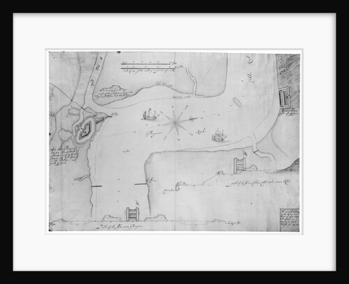
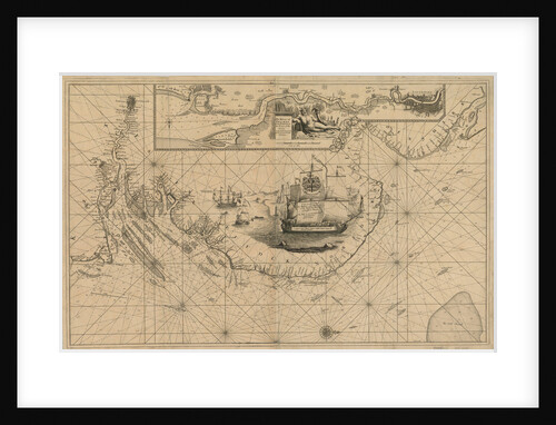
Gillingham and Cookham Bloods, River Medway
Bernard de Gomme
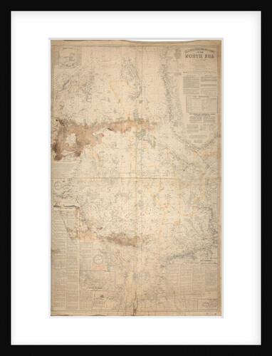
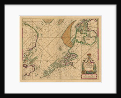
Close's fishermen's chart of the North Sea.
Albert Close
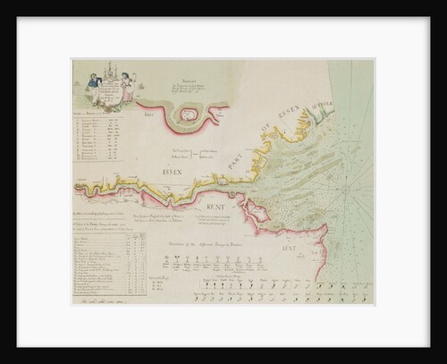
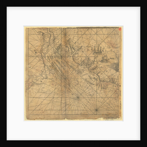
Chart of the River Thames and Estuary, 1790
Richard Stanier
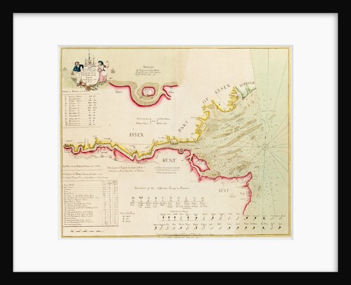
Chart of the River Thames from London to the Nore, Margate and the Downs, North, Middle and South Channels, from...
Richard Stanier
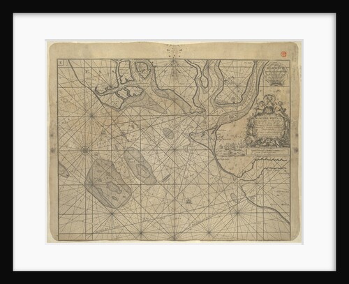
Chart of River Medway and part of the Thames: no.24 Sheerness
unknown
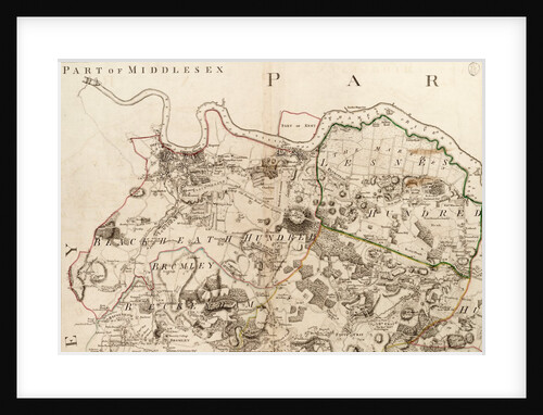
Map of Greenwich to Erith, London
John Andrews
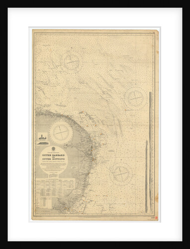
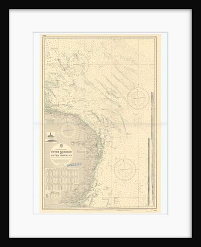
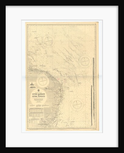
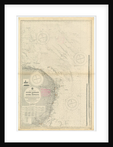
England East Coast: Outer Gabbard to Outer Dowsing
British Admiralty
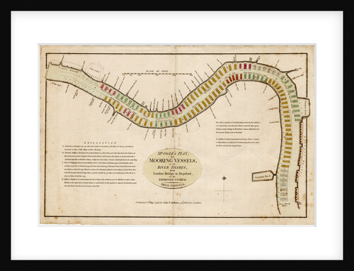
Mr Ogle's plan, for mooring vessels, in the River Thames, from London Bridge to Deptford, on an improved system
Edward Ogle
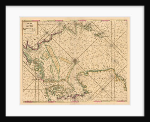
Chart of the North Sea: Norway to the Dover Straits
Mount & Page
A chart of the North Sea from South Foreland to Burnham Flatts, and from Callis to Schelling Isle
Mount & Page
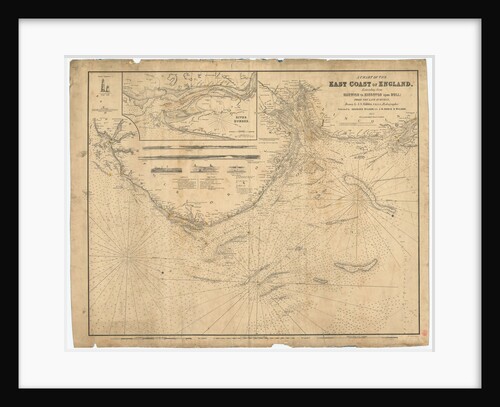
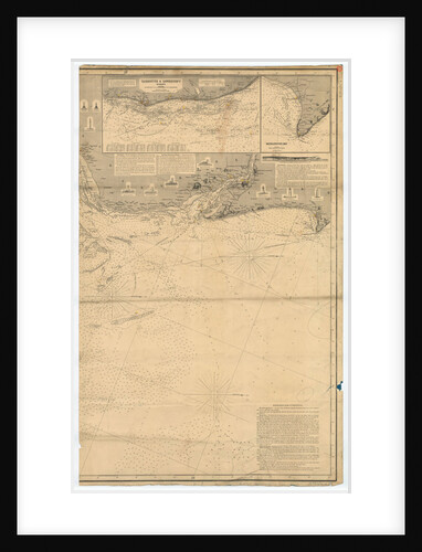
England East Coast: Harwich to Kingston Upon Hull
J.S. Hobbs
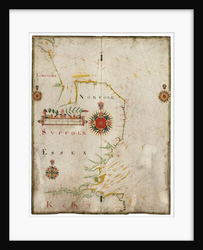
England, east coast, Spurn Head to South Foreland
John Thornton
Chart of the North Sea dedicated to 'Ye Honble Samuel Pepys Esq by Captain Greenvil Collins Hydrog to the King...
Captain Greenville Collins
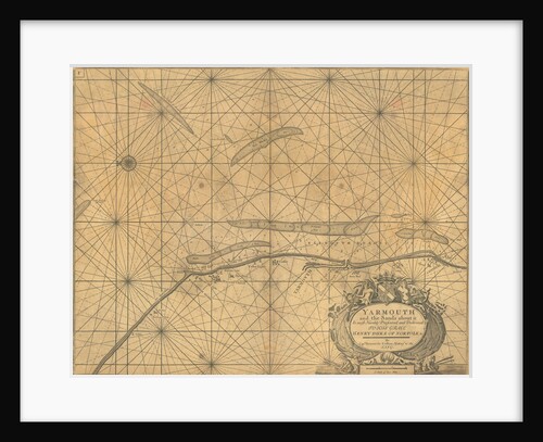
Chart of Yarmouth and the sands about it
Greenville
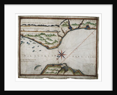
Chart of Dover Strait
Luis Teixeira
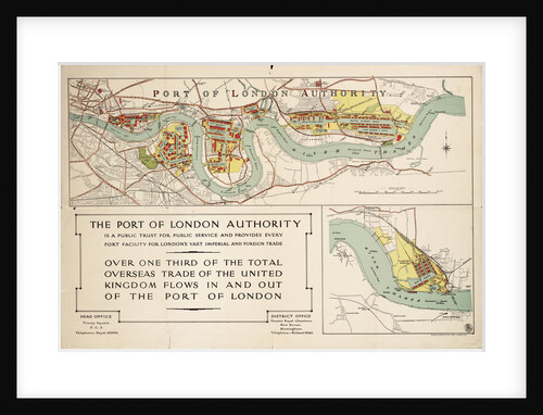
The Port of London Authority
Port of London Authority
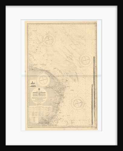
England-East Coast. Outer Gabbard to Outer Dowsing
British Admiralty
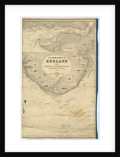
England East Coast from Dungeness to Flamborough Head
James Imray & Son
England East Coast from Dungeness to Flamborough Head
James Imray & Son
England-East Coast. Outer Gabbard to Outer Dowsing
British Admiralty
England-East Coast. Outer Gabbard to Outer Dowsing
British Admiralty
England-East Coast. Outer Gabbard to Outer Dowsing
British Admiralty
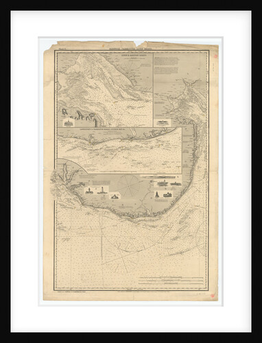
England East Coast: Harwich to Flamborough Head
Charles Wilson
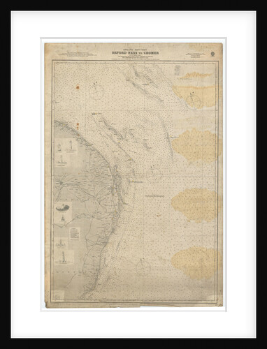
England East Coast: Orford Ness to Crome
British Admiralty
England East Coast from Dungeness to Flamborough Head
James Imray & Son
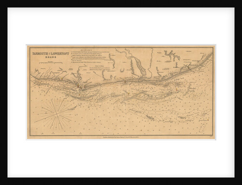
England East Coast: Yarmouth and Lowestoft Roads
James Imray & Son
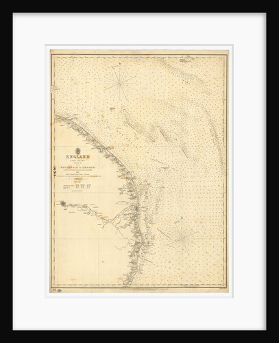
England East Coast: Southwolds to Cromer
British Admiralty
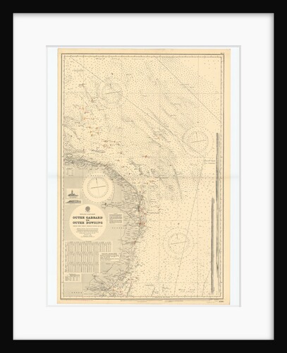
England-East Coast. Outer Gabbard to Outer Dowsing
British Admiralty
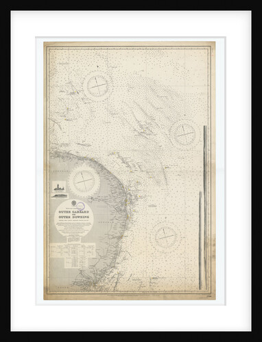
England-East Coast. Outer Gabbard to Outer Dowsing
British Admiralty
Chart of River Thames from London to the Buoy of the Noure
unknown
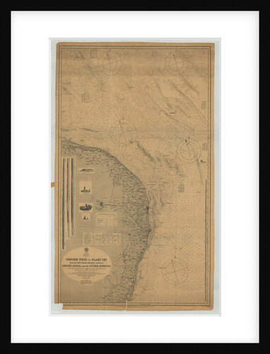
England East coast Orfordness to Blakeney with the off lying shoals between Smith's Knoll and the Outer Dowsing
British Admiralty
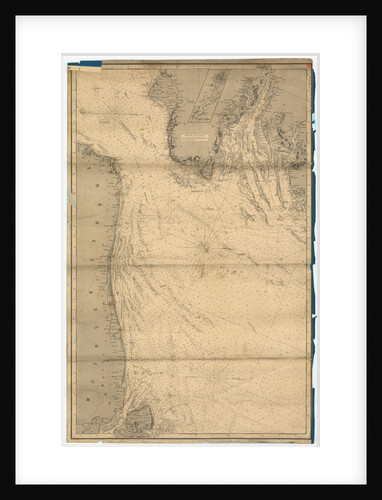
England East Coast from Thames Estuary to the Wash
Grenville Collins
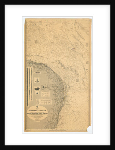
Orford Ness to Blakeney with the off lying shoals between Smiths Knoll and the other Dowsing
British Admiralty
England East Coast from Thames Estuary to the Wash
Grenville Collins
Recently viewed
Clear history