Skip to main content
10% off your first order
☰ Menu
Basket icon
Wishlist icon
Account icon
Search icon
Search icon
Inspiration
Collections
Astrophotography
Battles and wars at sea
Children's
Exploration
Graphic designs
Greenwich
Historic figures
Historic vessels
Maps and charts
Photography
Pirates
Seascapes
Time and space
Natural history
World travel
Ship plans
Gift cards
Contact
Contact us
Newsletter
Search art & photography
Search icon
Brown blue map prints
Showing 1 to 48 of 414
Search these images +
Search Brown blue map images
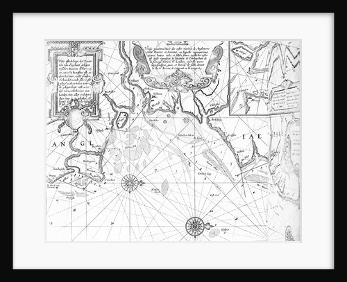
Speculum nauticum super navigatione maris occidentalis confectu, continens omnes oras maritimas Galliae, Hispaniae, and praecipuarum partium Angliae
Lucas Janz Waghenaer
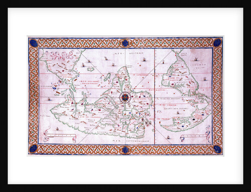
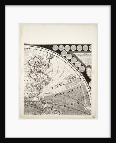
World planisphere
Francesco Rosselli
Plan of the environs of English Harbour, Antigua
John Brown
Plan of the environs of English Harbour and Monks Hill in the Island of Antigua surveyed and drawn by John...
John Brown
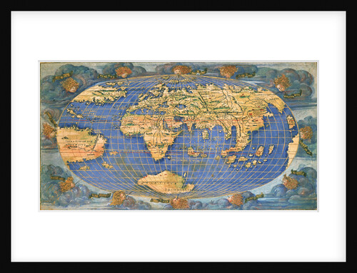
Planisphere world map by Francesco Rosselli, around 1508
Francesco Rosselli
Portulan chart constructed by William Borough showing the sea area of the North Sea and Baltic, from the east coast...
William Borough
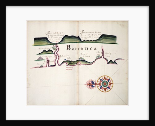
Barranca
William Hack
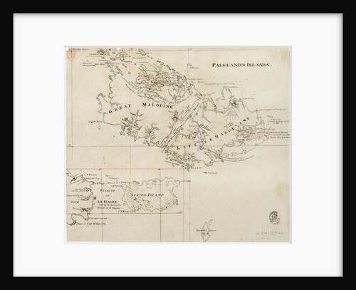
Falkland's Islands
Anonymous
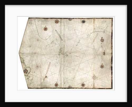
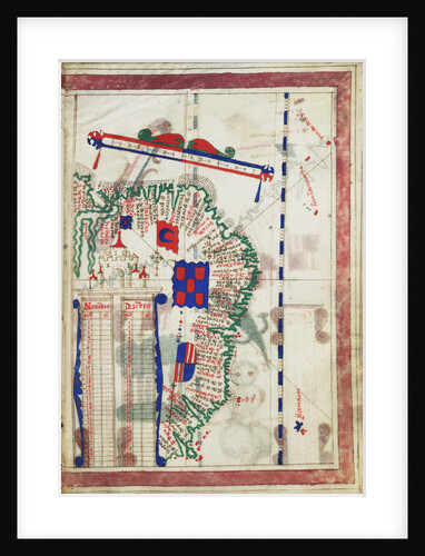
Portulan chart of the Atlantic
Pedro Reinel
World map by John Seller, 1675
John Seller
A description of the Sea Coast from Ye Point of Burica to C St. Francis
William Hack
Chart of Arnola Island, 1884
unknown
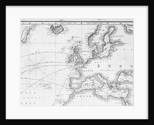
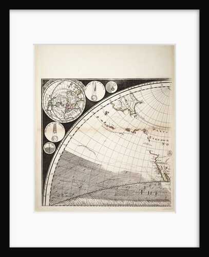
A general chart for the purpose of pricking off ship's track from England southward and round the world (detail)
J.S. Hobbs
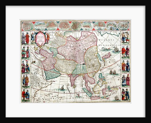
Map of Asia from the Bleau Atlas, 1662-65
unknown
Coronadoes, South American Pacific coast
William Hack
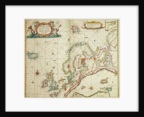
A general chart of the northern navigation
John Seller
A Mediterranean chart showing the North East Atlantic
Arnaldus Domenech
World map from Ptolemy's Cosmographia of 1492
Ptolemy
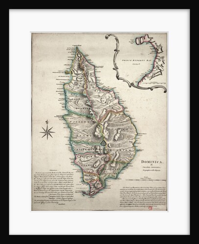
Colour map of Dominica with detailed geographical observations
Thomas Jeffereys
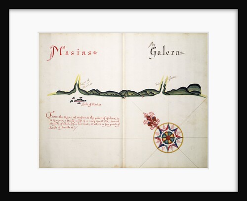
Masias and Galera
William Hack
A new and correct map of the world (section)
Sayer & Bennett
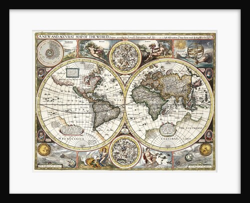
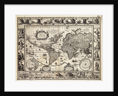
'A new and accurate map of the world' by John Speed, 1626
John Speed
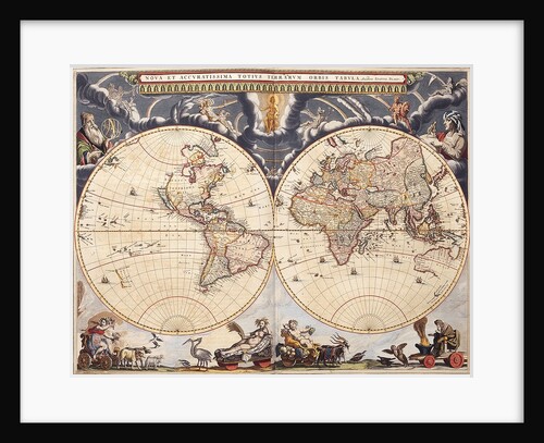
World map from the Blaeu Atlas, 17th century
John Blaeu
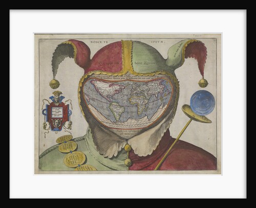
Fool's map of the world
Unknown
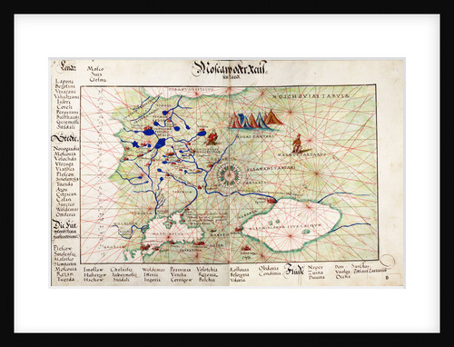
Chart of Moscow and the Black Sea
Johan B. Agnese
The Thames Estuary from The Sea-Mirrour atlas by Willem Janszoon Blaeu, published in Amsterdam in 1633
Willem Janszoon Blaeu
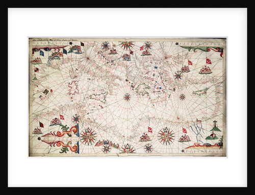
Chart of the Mediterranean circa 1640
Joan Oliva
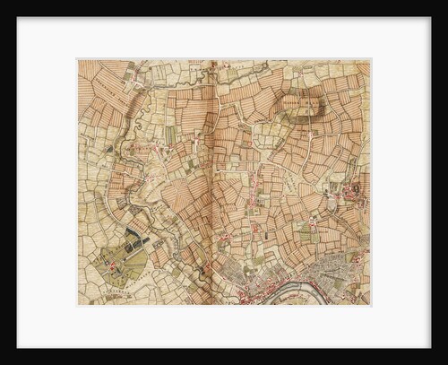
Map of Greenford, Osterley, Ealing and Kew
John Rocque
A new and correct map of the world (section)
Sayer & Bennett
Mercator map of the world, 1606
W.J. Blaeu
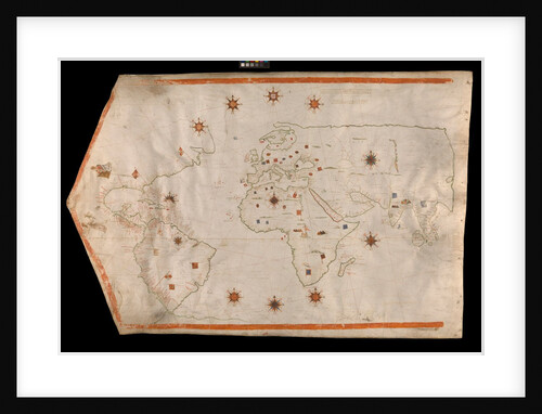
World map on vellum
Brother of Giovanni Verrazano
Map of 'The pursuit to Calais, 4 - 6 August 1588'
Robert Adams; Augustine Ryther
Straits of Magellan and Le Maire, South American Pacific coast
William Hack
Mediterranean, Black Sea and the North East Atlantic
Vesconte Maggiolo
Chart of Romney Marsh
Elhanan Tucker
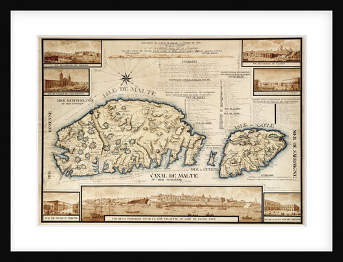
French chart of Malta, circa 1798
unknown
Chart of Paraguay, Chile, Straits of Magellan and Tierra del Fuego in South America
Nicholas Visscher
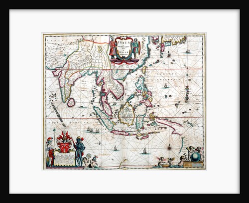
Map of Asia from the Blaeu Atlas, 1662-1665
unknown
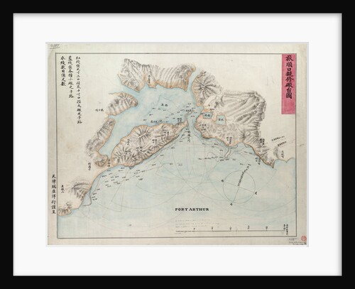
Chart of Port Arthur
Anonymous
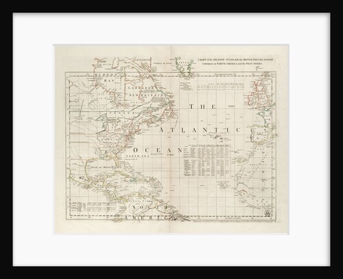
Chart of the Atlantic Ocean, with the British, French & Spanish settlements in North America and the West Indies
Thomas Jefferys
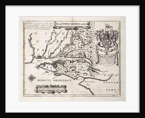
Map of Nova Terrae-Mariae tabula
John Ogilby
Map of the Gulf and River of St Lawrence
Joseph Frederick Wallet Des Barres
World chart by Pierre Hamon, 1568
Pierre Hamon
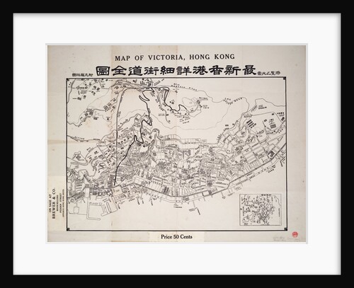
Map of Victoria, Hong Kong
Anonymous
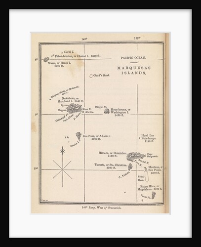
Map of Marquesas Islands from Herman Melville's 'A narrative of a four month's residence among the natives of a valley...
unknown
A new and correct map of the world (section)
Sayer & Bennett
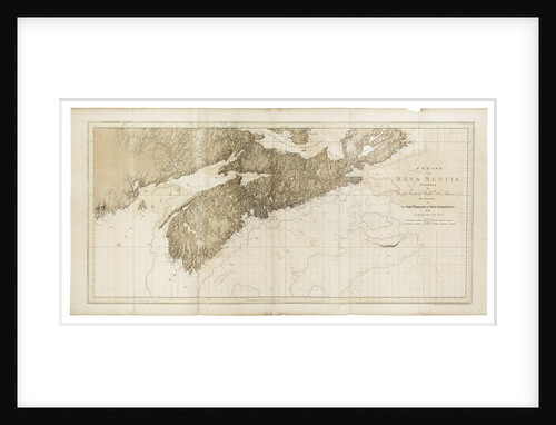
A chart of Nova Scotia
Joseph Frederick Wallet Des Barres
Chart of Brazil: Rio de Janeiro to River Amazon
unknown
1
2
3
…
9
Next »
Recently viewed
Clear history