Skip to main content
10% off your first order
☰ Menu
Basket icon
Wishlist icon
Account icon
Search icon
Search icon
Inspiration
Collections
Astrophotography
Battles and wars at sea
Children's
Exploration
Graphic designs
Greenwich
Historic figures
Historic vessels
Maps and charts
Photography
Pirates
Seascapes
Time and space
Natural history
World travel
Ship plans
Gift cards
Contact
Contact us
Newsletter
Search art & photography
Search icon
Home
Collections
Products
Products
page 166
Showing 7921 to 7968 of 25001
Featured
A-Z
Z-A
Oldest to newest
Newest to oldest
Bestselling
Products
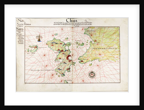
Chart of Chius (Chios, Greece), 1554
Battista Agnese
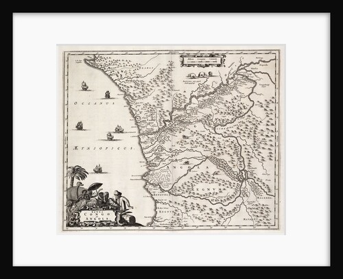
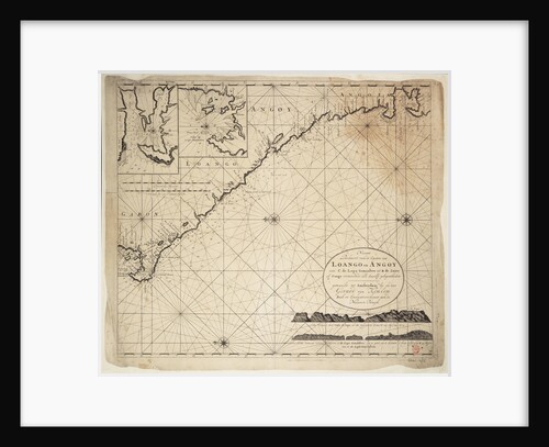
Chart of Congo and Angola, Africa
John Ogilby
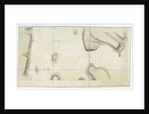
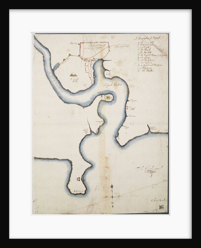
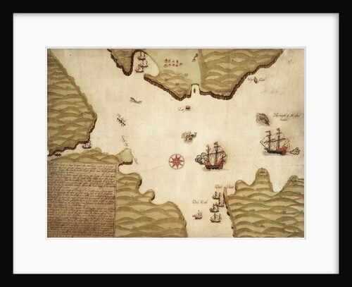
Chart of Cork harbour, Ireland
unknown
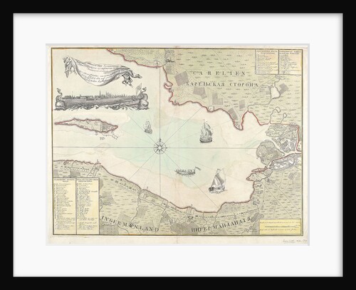
Chart of Cronstadt, circa 1720 (with key)
unknown
Chart of discoveries made in the South Pacific Ocean in his majesty's ship 'Resolution' under the command of Captain Cook
James Cook
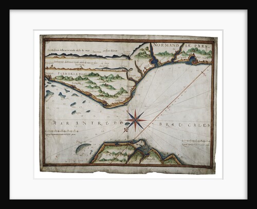
Chart of Dover Strait
Luis Teixeira
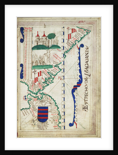
Chart of Estrecho de Magalhanes (Magellan Strait)
unknown
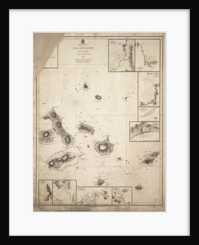
Chart of Galapagos Islands surveyed during voyage of HMS 'Beagle'
Robert Fitzroy
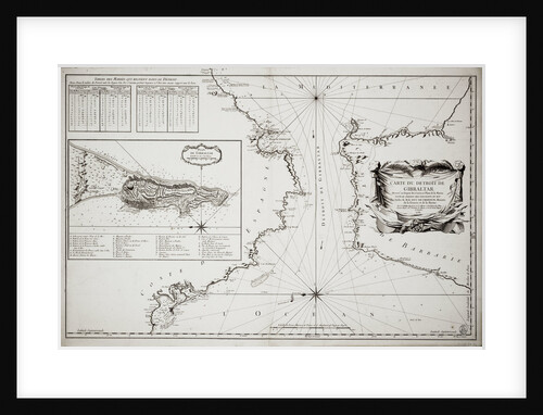
Chart of Gibraltar
Jacques Nicolas Bellin
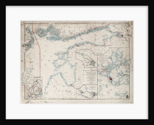
Chart of Gulf of Finland and Baltic
James Wyld
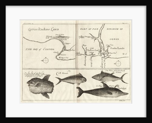
Chart of Gulf of Guinea, Africa
Gerard van Keulen
Chart of Gulf of Guinea, Africa
Gerard van Keulen
Chart of Ipswich Bay and Cape Ann, Atlantic coast of North America
J.F.W. Des Barres
Chart of Ipswich Bay and Cape Ann, Atlantic coast of North America
J.F.W. Des Barres
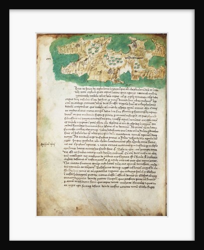
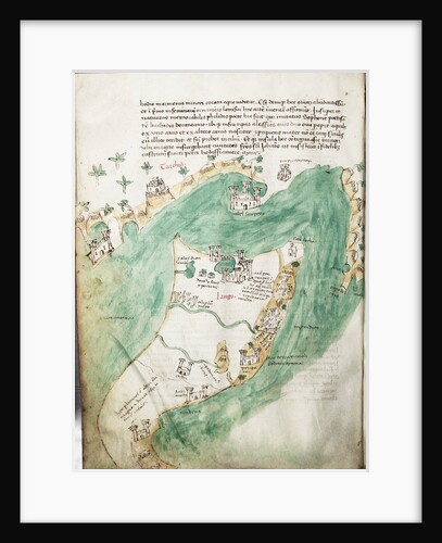
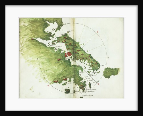
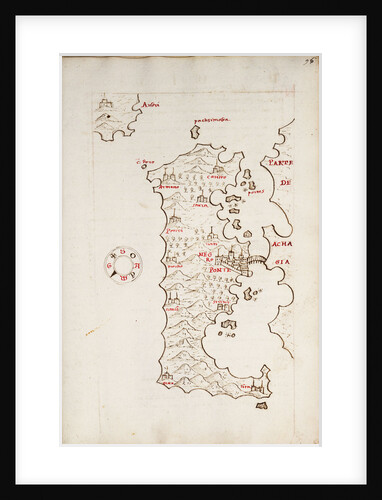
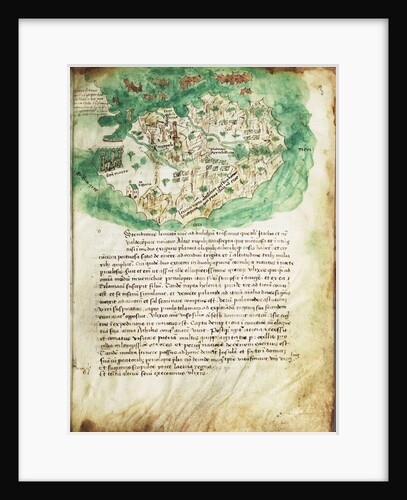
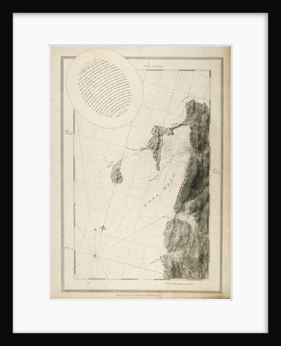
Chart of Ithaki
Cristoforo Buondelmonti
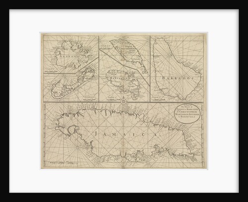
Chart of Jamaica, Barbados, St Christopher, Martinique, Antigua and Bermuda
John Seller
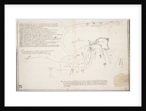
Chart of Kinsale
John Mansell
Chart of Kinsale
Unknown
Chart of Kos and Bodrum
Cristoforo Buondelmonti
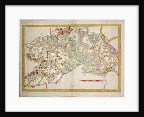
Chart of Leix and Offaly, Ireland
Anonymous
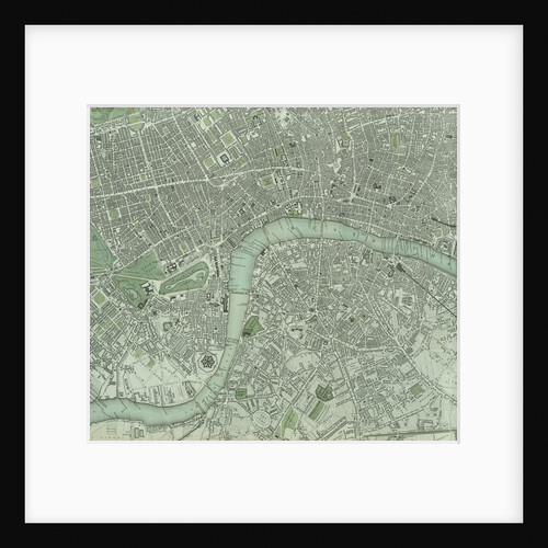
Chart of London City and the river Thames
Unknown
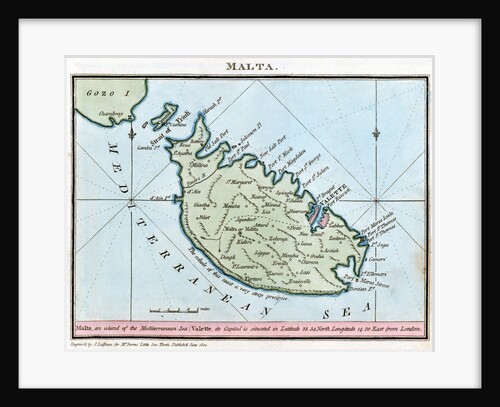
Chart of Malta
R. Bougard
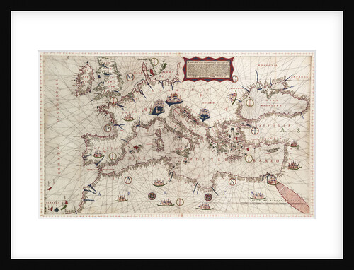
Chart of Mediterranean and north east Atlantic
Sebastiao Lopes
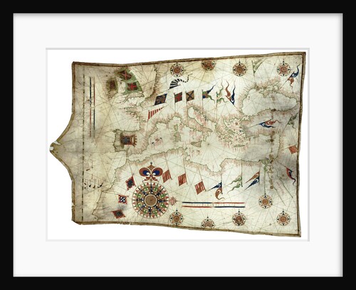
Chart of Mediterranean Sea, with part of the Black Sea
Placido Caloiro y Oliva
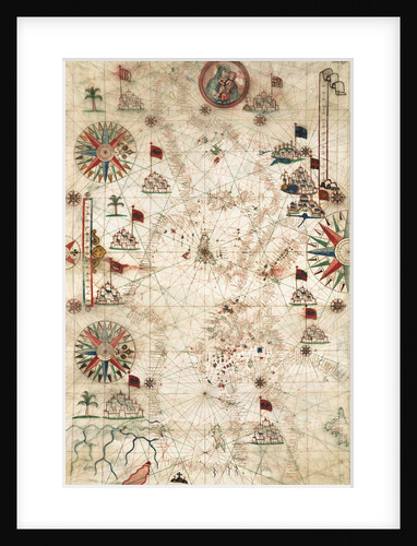
Chart of Mediterranean, Black and Caspian Seas
unknown
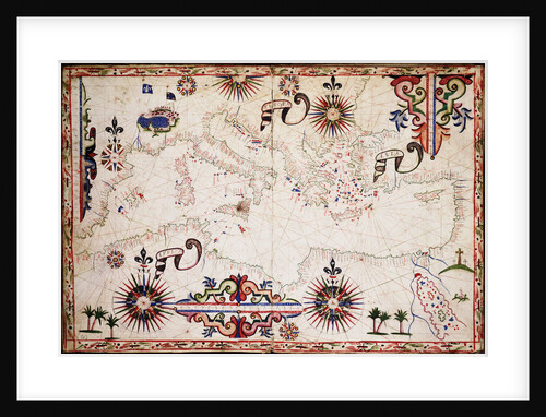
Chart of Mediterranean, Black and Caspian seas
John Burston
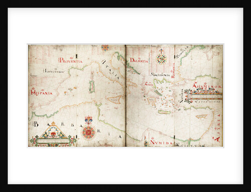
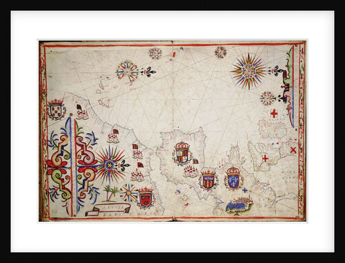
Chart of Mediterranean, Black and Caspian Seas, 16th century
Paulo Forlani
Chart of Milford Haven in St Georges and Bristol Channel
Paul Ive
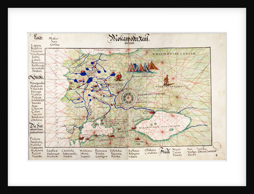
Chart of Moscow and the Black Sea
Johan B. Agnese
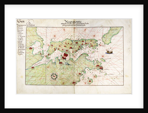
Chart of Negroponte
Bartolommeo dalli Sonetti
Chart of Negroponte
Battista Agnese
Chart of Negroponte
Antonio Millo
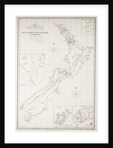
Chart of New Zealand
Thomas McDonnell
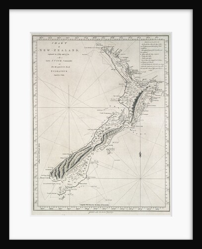
Chart of New Zealand, explored in 1769 and 1770 by Lieutenant J.Cook, Commander of His Majesty's Bark Endeavour
James Cook
Chart of north-east Atlantic, from British Isles to Cape Verde
unknown
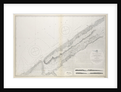
Chart of Nova Scotia, Bay of Fundy, Gullivers Hole to St Croix Bay, first published 10th February 1858
Unknown
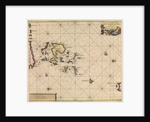
Chart of Orcades Eylande (Orkneys) from van Keulen's 'Great and Newly Enlarged Sea Atlas', 1682
Johannes van Keulen
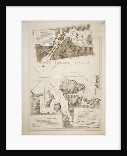
Chart of Oyster Bay and Huntington Bay, Long Island Sound
Joseph Frederick Wallet Des Barres
Chart of Paraguay, Chile, Straits of Magellan and Tierra del Fuego in South America
Nicholas Visscher
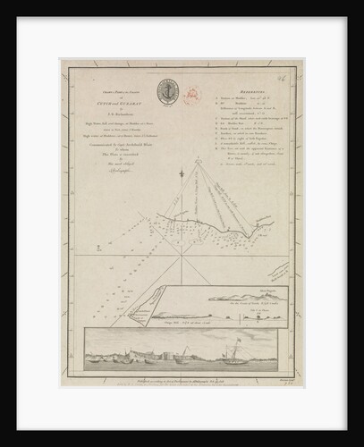
Chart of part of the coasts of Cutch and Guzarat by J G Richardson... communicated by Capt Archibald Blair to...
British Admiralty
Chart of Paxos
Cristoforo Buondelmonti
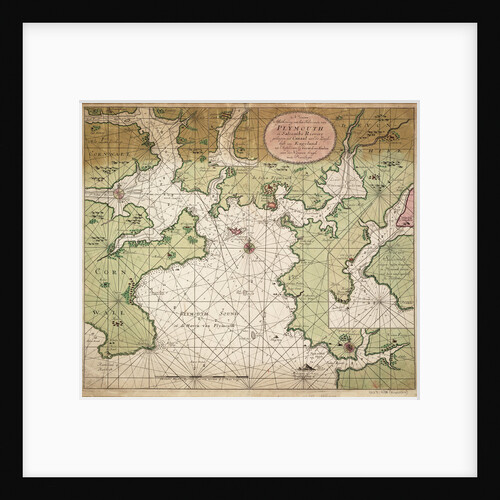
Chart of Plymouth Sound, from Greenville Collins's 1693 chart of the English Channel
Gerard van Keulen
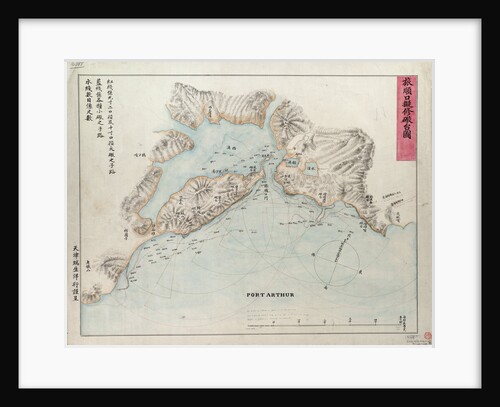
Chart of Port Arthur
Anonymous
Chart of Port Hood, 1776
Joseph Frederick Wallet Des Barres
Chart of Port Royal in South Carolina, United States of America
J.F.W. Des Barres
Chart of Prusya with all the havens and rivers from Memel to Heel
Lucas Janz Waghenaer
Chart of River Medway and part of the Thames: no.24 Sheerness
unknown
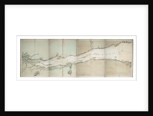
Chart of river of St. Lawrence, North America Atlantic coast
J. F. W. Des Barres
« Previous
1
…
164
165
166
167
168
…
521
Next »
Recently viewed
Clear history