Skip to main content
10% off your first order
☰ Menu
Basket icon
Wishlist icon
Account icon
Search icon
Search icon
Inspiration
Collections
Astrophotography
Battles and wars at sea
Children's
Exploration
Graphic designs
Greenwich
Historic figures
Historic vessels
Maps and charts
Photography
Pirates
Seascapes
Time and space
Natural history
World travel
Ship plans
Gift cards
Contact
Contact us
Newsletter
Search art & photography
Search icon
Home
Collections
Maps and charts
Maps and charts
page 17
Showing 769 to 816 of 917
Featured
A-Z
Z-A
Oldest to newest
Newest to oldest
Bestselling
Products
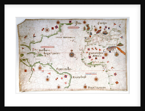
Portulan chart of the Atlantic
Pedro Reinel
Portulan chart constructed by William Borough showing the sea area of the North Sea and Baltic, from the east coast...
William Borough
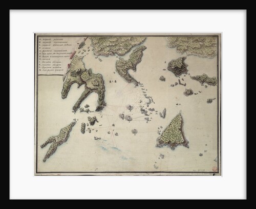
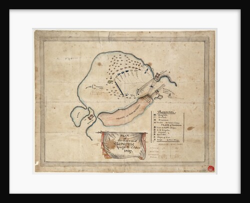
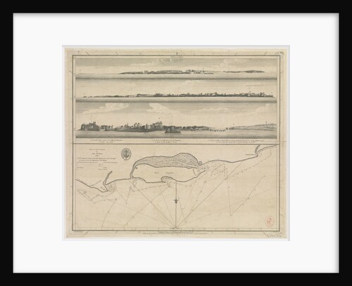
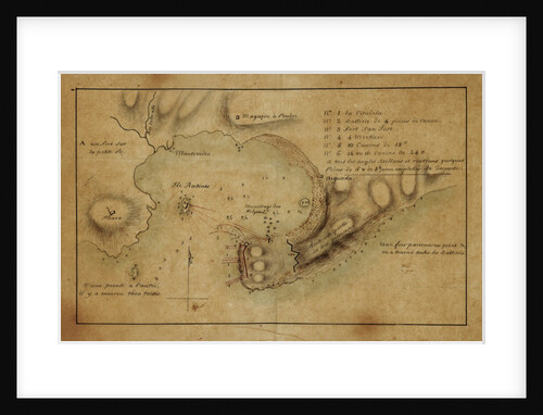
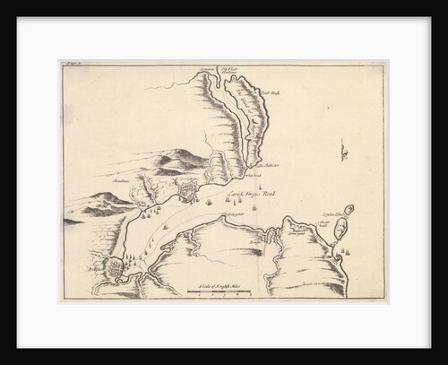
Plan of the taking of Barasound in Finland
unknown
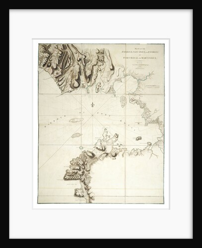
Plan of the harbour, fort, town and environs of Fort Royal in Martinique
William Booth
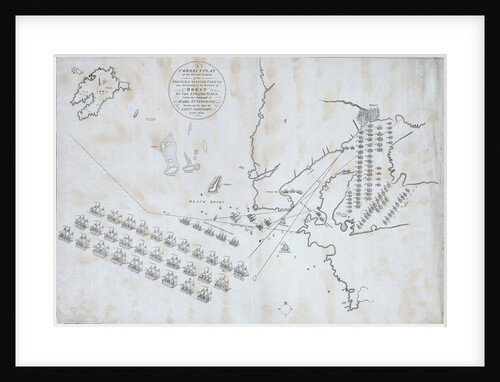
Plan of the French & Spanish Fleets blockaded by the English Fleet under the command of Earl St Vincent. January...
Lt John Grey
Plan of the environs of English Harbour and Monks Hill in the Island of Antigua surveyed and drawn by John...
John Brown
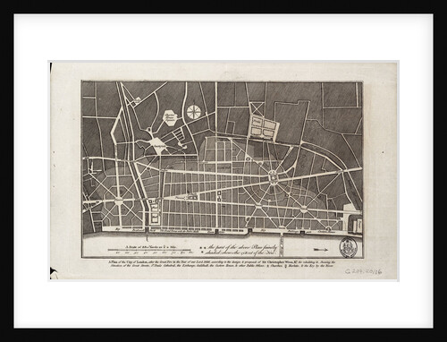
Plan of the City of London after the Great Fire of 1666
Christopher Wren
Plan of the Battle of Navarino, 21 October 1827
unknown
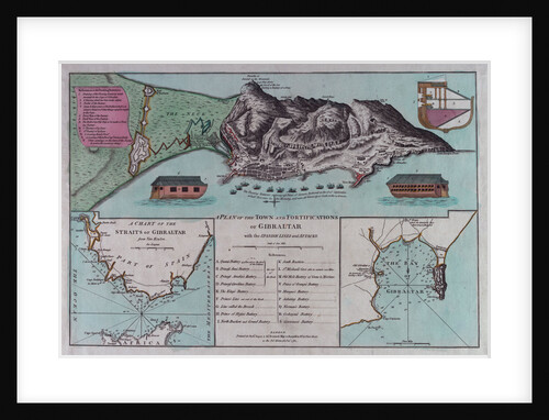
Plan of Gibraltar
Robert Sayer & John Bennett
Plan of Diu Island by John McCluer 1788
British Admiralty
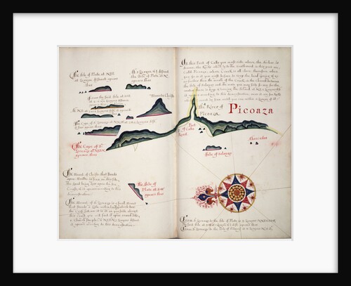
Picoaza
William Hack
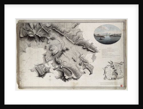
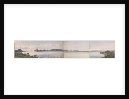
Panorama of Rio de Janeiro, Brazil
Edward Gennys Fanshawe
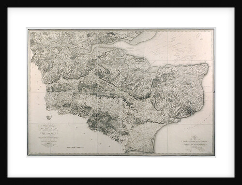
Ordnance Survey map of Kent
unknown
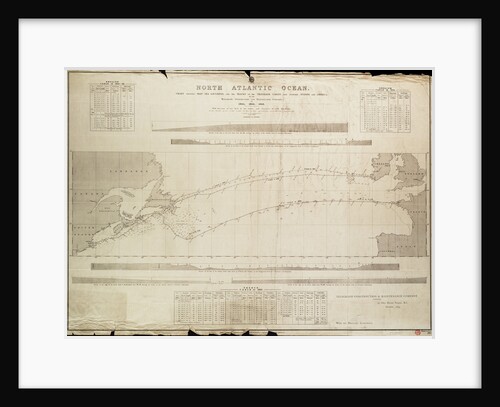
North Atlantic Ocean Chart showing deep sea soundings and tracks of telegraph cables
Malby
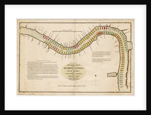
Mr Ogle's plan, for mooring vessels, in the River Thames, from London Bridge to Deptford, on an improved system
Edward Ogle
Montevideo
unknown
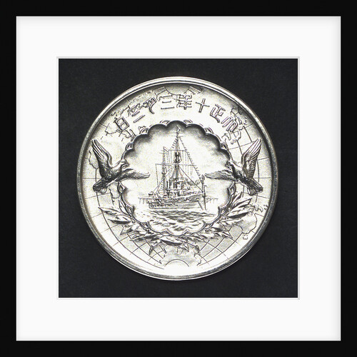
Medal commemorating the visit of the Crown Prince of Japan to England, 1921; reverse
S. Nakano
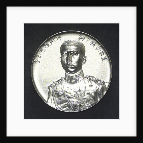
Medal commemorating the visit of the Crown Prince of Japan to England, 1921; obverse
S. Nakano
Medal commemorating the Kara Sea Expedition, 1919; reverse
unknown
Medal commemorating the capture of the Morea, 1687; reverse
M. Brunner
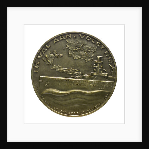
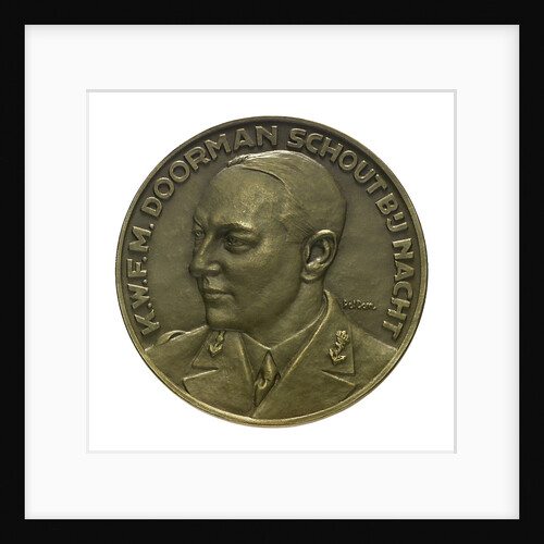
Medal commemorating the Battle of the Java Sea, 1942; reverse
Poldon
Medal commemorating the Battle of the Java Sea, 1942; obverse
Poldon
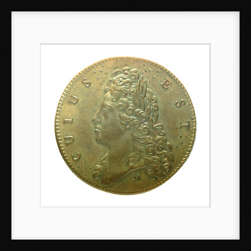
Medal commemorating the attempts of the Elder Pretender to recover the English Throne in 1708 and 1716; obverse
unknown
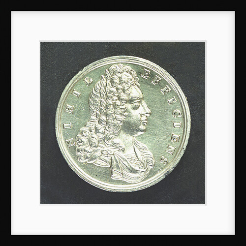
Medal commemorating James, the Elder Pretender; obverse
N. Roettier
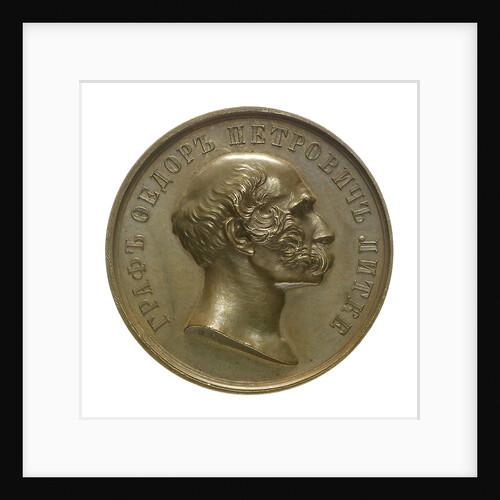
Medal commemorating Admiral Count Lutke; obverse
B.V. Alexejeff
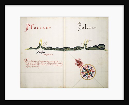
Masias and Galera
William Hack
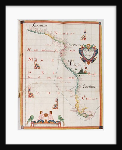
Mar del Zur
William Hack
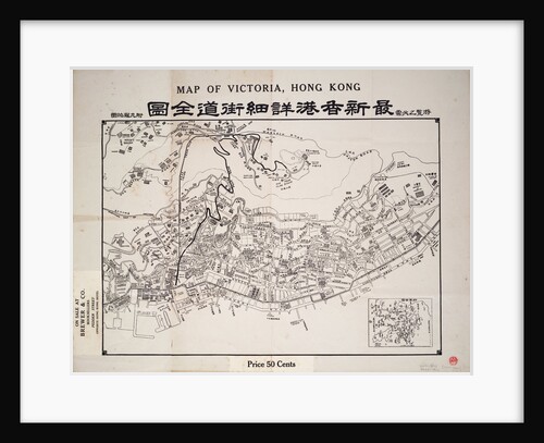
Map of Victoria, Hong Kong
Anonymous
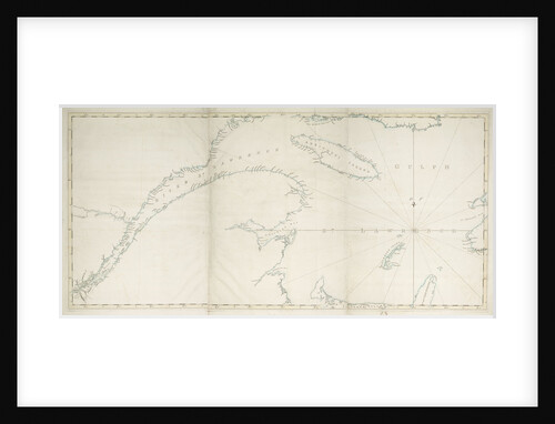
Map of the Gulf and River of St Lawrence
Joseph Frederick Wallet Des Barres
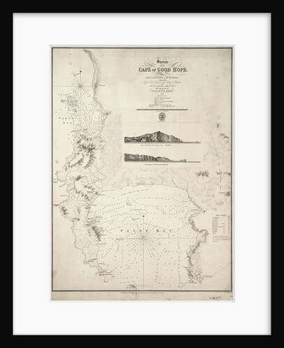
Map of the Cape of Good Hope
J. & C. Walker
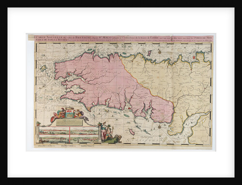
Map of St. Malo, France
Romeyn de Hooghe
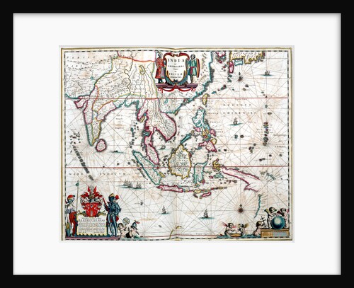
Map of South America
Herman Moll
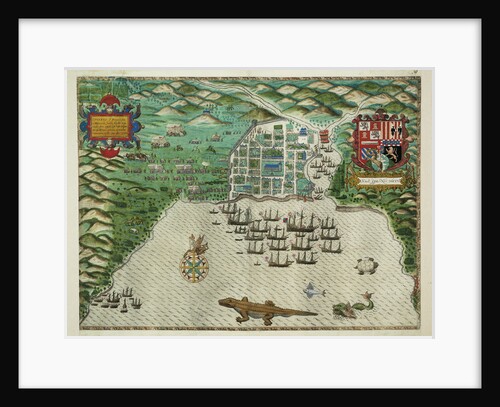
Map of Santo Domingo
Baptista Boazio
Map of Quebec, Canada
Sayer & Bennett
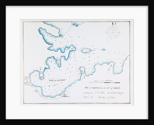
Map of Port St George in the Island of Lissa as surveyed by Mr W White, Master HMS 'Eagle', March...
William Innes Pocock
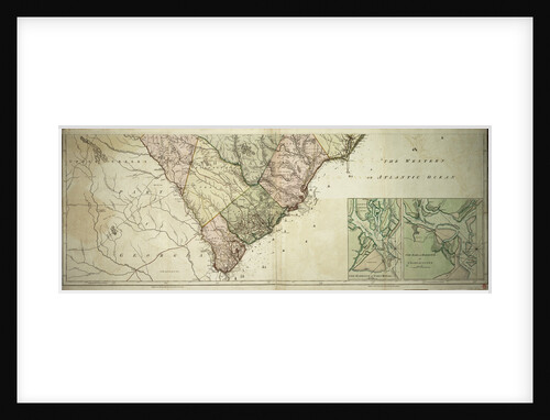
Map of North and South Carolina
Sayer & Bennett
Map of North and South Carolina
Sayer & Bennett
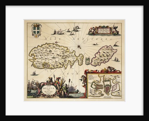
Map of Malta and Gozo
unknown
Map of Lismore, Ireland
unknown
Map of Hoogly River
unknown
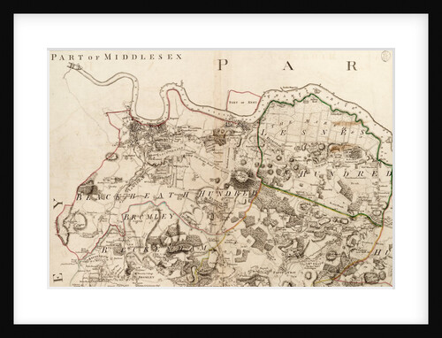
Map of Greenwich to Erith, London
John Andrews
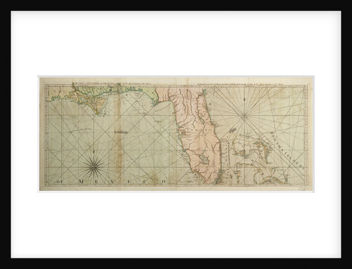
Map of Florida, 1775
Thomas Jefferys
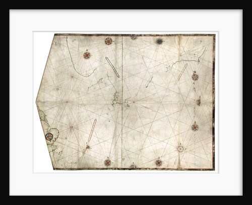
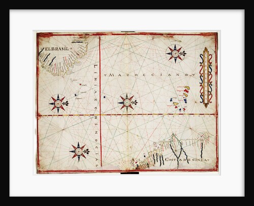
Map of central Atlantic
Joan Oliva
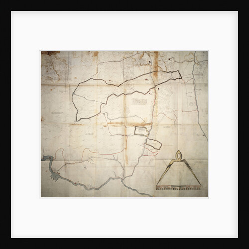
Map of Carrickfergus, 28 August 1689
unknown
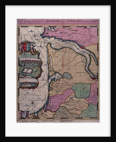
Map of Bordeaux, France
Romeyn de Hooghe
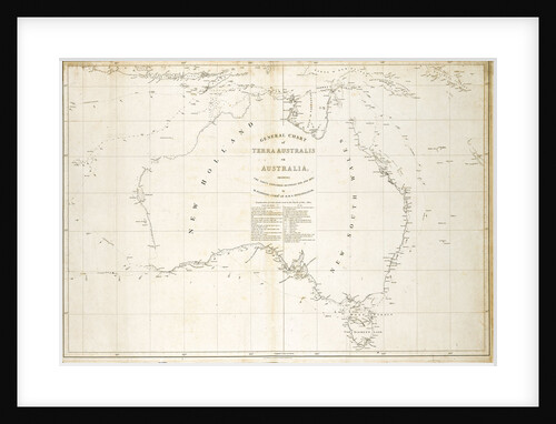
Map of Australia
Matthew Flinders
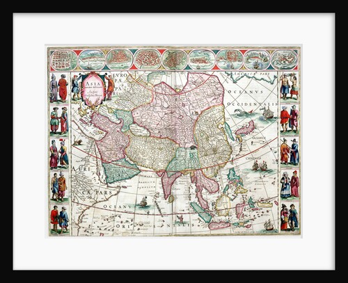
Map of Asia from the Bleau Atlas, 1662-65
unknown
Map of Asia from the Blaeu Atlas, 1662-1665
unknown
« Previous
1
…
15
16
17
18
19
20
Next »
Recently viewed
Clear history