Skip to main content
10% off your first order
☰ Menu
Basket icon
Wishlist icon
Account icon
Search icon
Search icon
Inspiration
Collections
Astrophotography
Battles and wars at sea
Children's
Exploration
Graphic designs
Greenwich
Historic figures
Historic vessels
Maps and charts
Photography
Pirates
Seascapes
Time and space
Natural history
World travel
Ship plans
Gift cards
Contact
Contact us
Newsletter
Search art & photography
Search icon
Home
Collections
Maps and charts
Maps and charts
page 16
Showing 721 to 768 of 917
Featured
A-Z
Z-A
Oldest to newest
Newest to oldest
Bestselling
Products
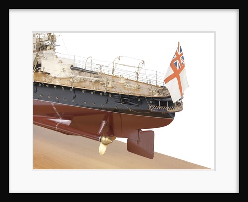
HMS 'Leviathan' (1901)
John Brown & Co. Ltd
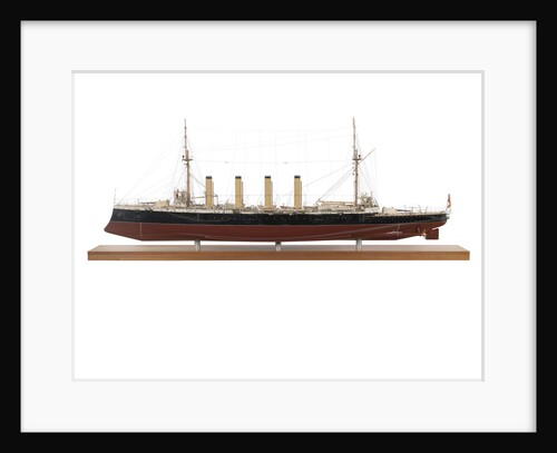
HMS 'Leviathan' (1901)
John Brown & Co. Ltd
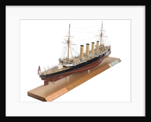
HMS 'Leviathan' (1901)
John Brown & Co. Ltd
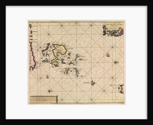
Chart of Orcades Eylande (Orkneys) from van Keulen's 'Great and Newly Enlarged Sea Atlas', 1682
Johannes van Keulen
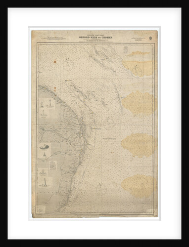
England East Coast: Orford Ness to Crome
British Admiralty
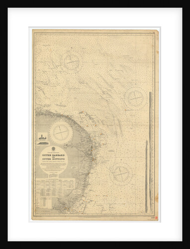
England East Coast: Outer Gabbard to Outer Dowsing
British Admiralty
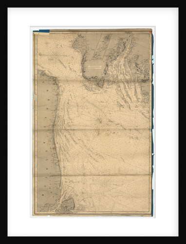
England East Coast from Dungeness to Flamborough Head
James Imray & Son
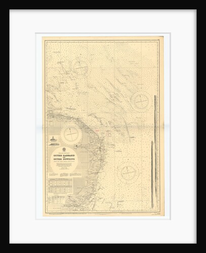
England-East Coast. Outer Gabbard to Outer Dowsing
British Admiralty
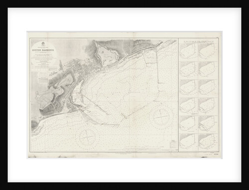
Admiralty Chart of Dover Harbour (1937)
unknown
Chart of Algiers Bay, 1620
Robert Norton
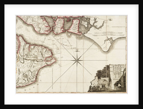
Hampshire or the county of Southampton including the Isle of Wight
Thomas Milne
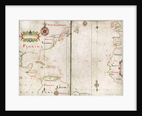
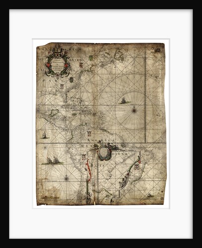
Atlantic Ocean, 5 degrees south to 57 degrees north
Nicholas Comberford
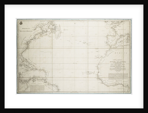
A general chart of the Atlantic Ocean north of the Equator
Deposito Hidrografico
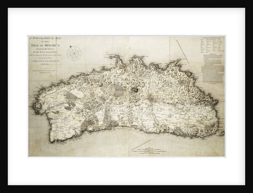
Map of Minorca, 1780
L. S. de la Rochette
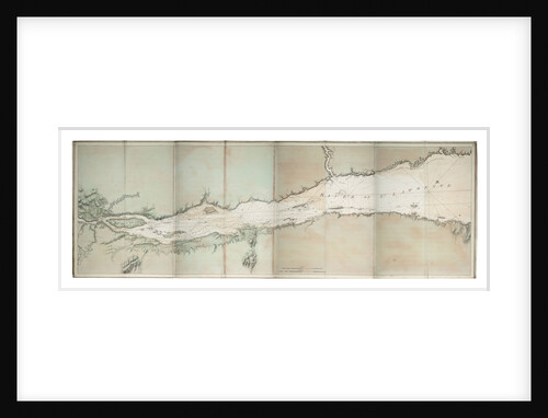
Chart of river of St. Lawrence, North America Atlantic coast
J. F. W. Des Barres
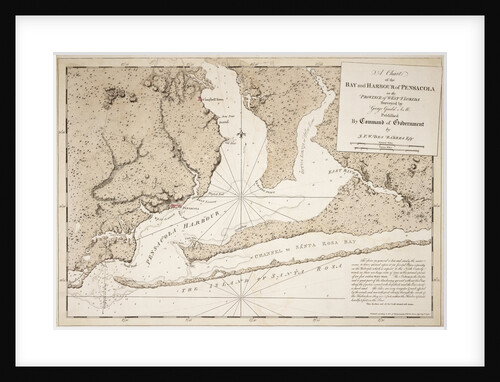
A chart of the bay and harbour of Pensacola in the province of West Florida
J.F.W. Des Barres
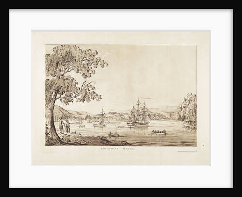
Annapolis Royal
J.F.W. Des Barres
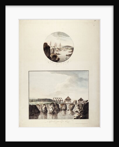
Views of the Mechios River
J.F.W. Des Barres
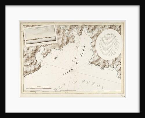
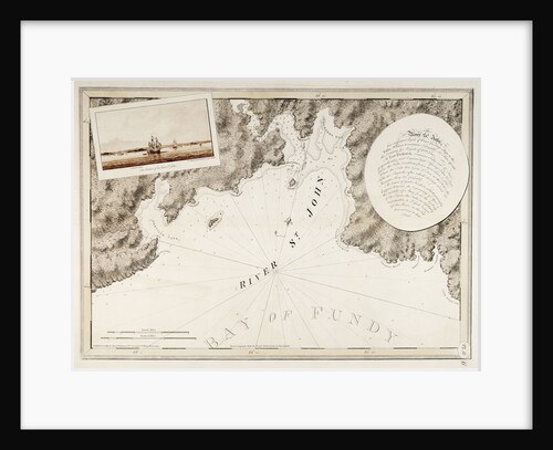
The River St. John
J. F. W. Des Barres
Western Atlantic Ocean
Pieter Goos
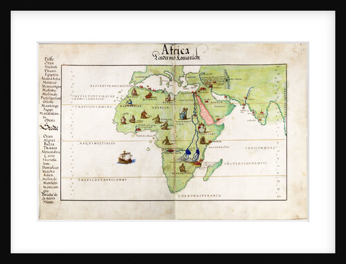
Vellum chart of Africa, India and the Mediterranean
Battista Agnese
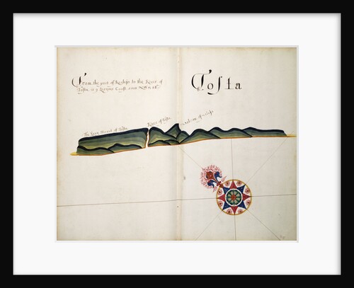
Tosta
William Hack
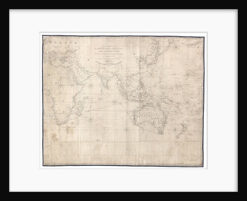
To the officers in the honourable East India Company's service this outline chart intended for their use to prick off...
J.W. Norie
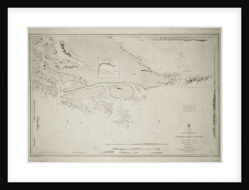
The south-eastern part of Tierra del Fuego with Staten Island, Cape Horn and Diego Ramirez Island
Robert Fitzroy
The River St. John
J. F. W. Des Barres
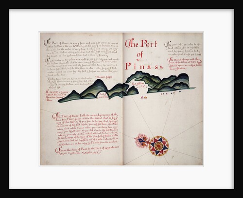
The Port of Pinas
William Hack
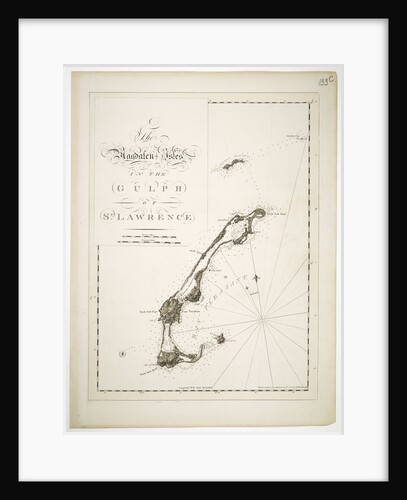
The Magdalen Isles in the gulph of St. Lawrence
J.F.W. Des Barres
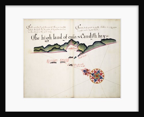
The High Land of Cano & Candish Bay
William Hack
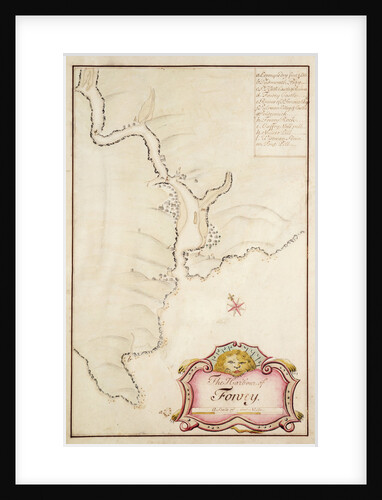
The harbour of Fowey, Cornwall
Edmond Dummer
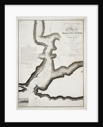
The harbour of Fowey, Cornwall
Hydrographical Office
The English engage the Spanish fleet near Plymouth on 31 July, 1588
Robert Adams
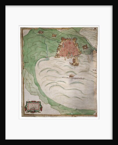
The description of the castle and landes of Insbeguin lying within 3 miles of Yohall on the west side thereof
unknown
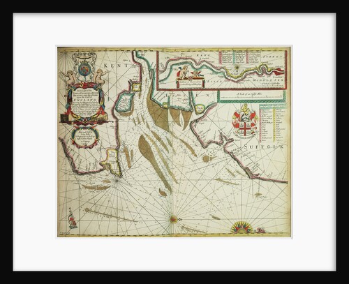
The coast of England from the Southforeland to Orfordness
John Seller
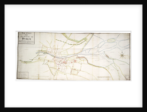
The city and suburbs of Dublin, 1673
unknown
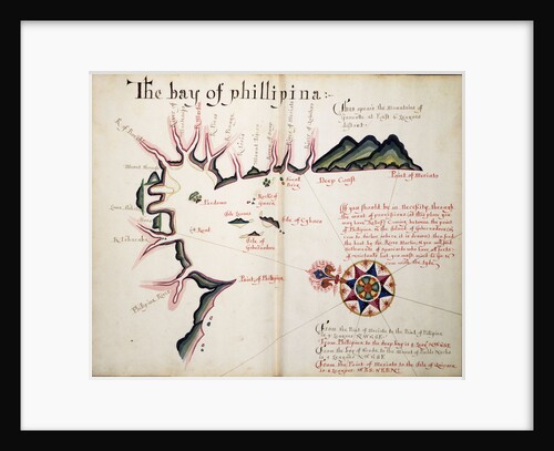
The Bay of Phillipina
William Hack
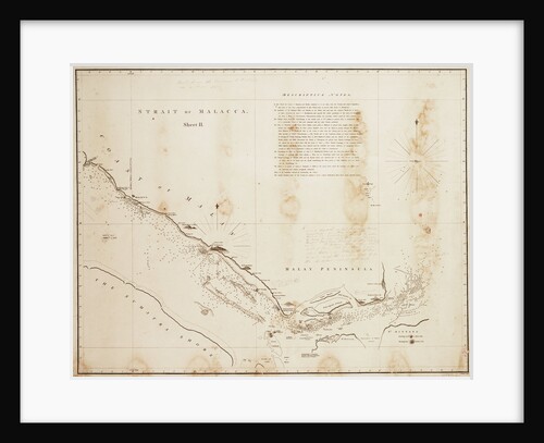
Strait of Malacca
unknown
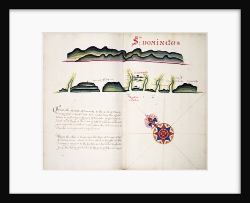
Sta Domingo
William Hack
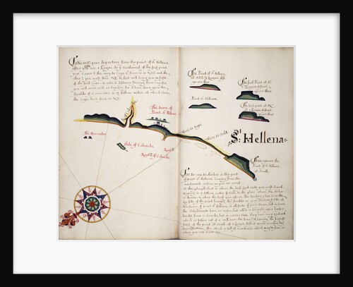
St Hellena
William Hack
Sphere and stand
Martin Behaim
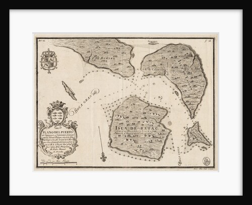
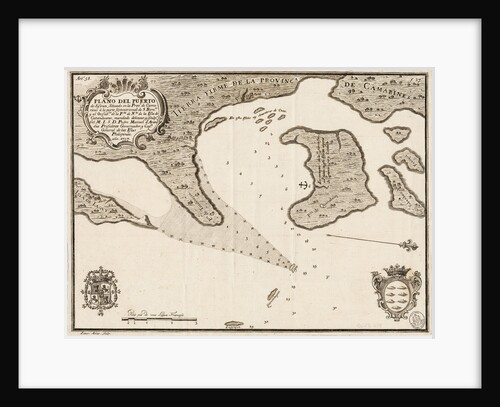
South China Sea
Pedro Manuel de Arandia
South China Sea
Pedro Manuel de Arandia
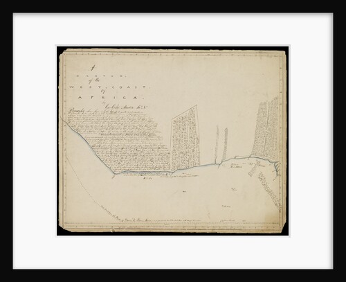
Sketch of the west coast of Africa
George Giles
Sheet from Bleau's 'Atlas of the Americas'
John Blaeu
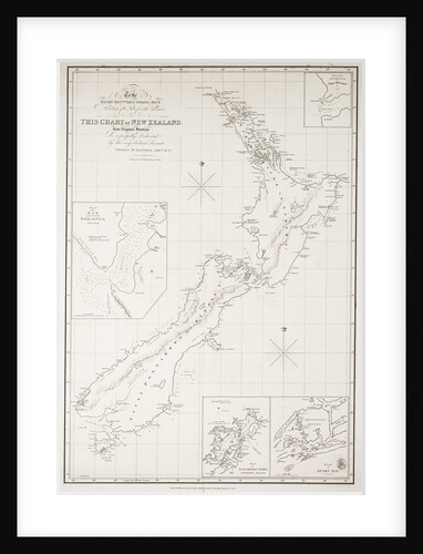
Chart of New Zealand
Thomas McDonnell
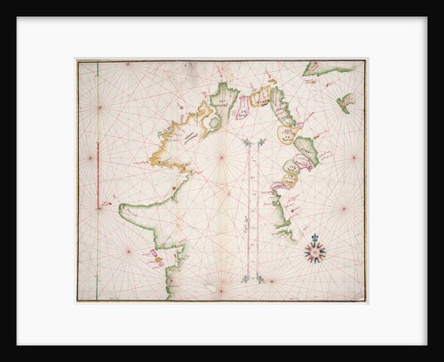
Sea chart of the north coast of Ireland
unknown
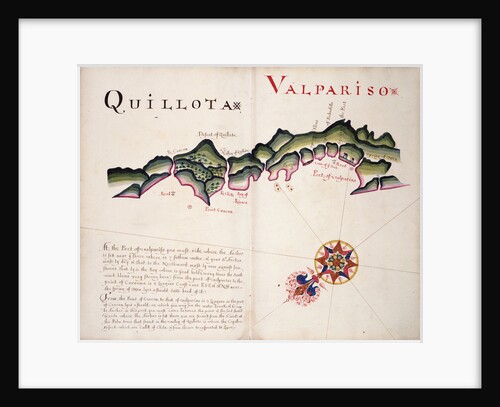
Quillota and Valpariso, South American Pacific coast
William Hack
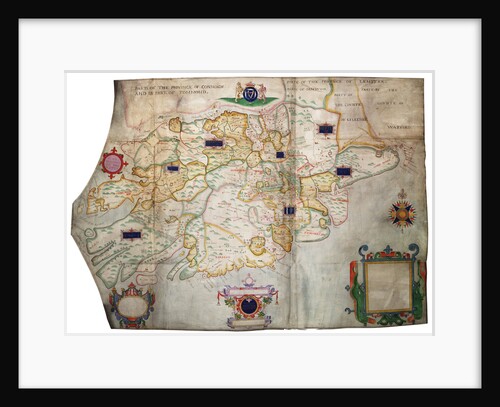
Province of Munster, Ireland
Francis Jobson
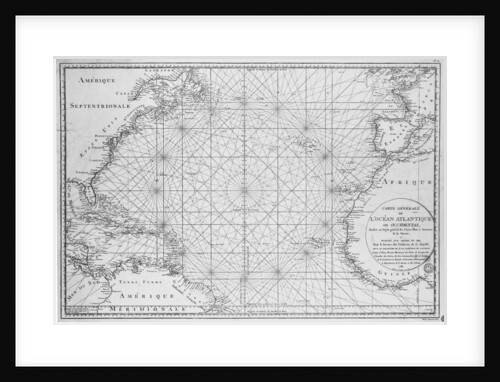
Printed chart of the North Atlantic Ocean by French Admiralty
Depot De La Marine
« Previous
1
…
14
15
16
17
18
…
20
Next »
Recently viewed
Clear history