Skip to main content
10% off your first order
☰ Menu
Basket icon
Wishlist icon
0
Account icon
Search icon
Search icon
Inspiration
Collections
Astrophotography
Battles and wars at sea
Children's
Exploration
Graphic designs
Greenwich
Historic figures
Historic vessels
Maps and charts
Photography
Pirates
Seascapes
Time and space
Natural history
World travel
Ship plans
Art gifts
Cushions
Notebooks
Journals
Gift cards
Contact
Contact us
Newsletter
Search art & photography
Search icon
Home
Collections
Maps and charts
Maps and charts
page 2
Showing 49 to 96 of 159
Featured
A-Z
Z-A
Oldest to newest
Newest to oldest
Bestselling
Products
Map of Turkey showing telegraph cables and stations
Anonymous
Chart of the River Thames and Estuary, 1790
Richard Stanier
World map from the Blaeu Atlas, 17th century
John Blaeu
World map by John Seller, 1675
John Seller
World map after Ptolemy, 1513
unknown
Vellum chart of Cyprus, 1554
Battista Agnese
Plan of Tortola from survey by George King
George King
Mercator map of the world, 1606
W.J. Blaeu
Map of Wimbledon and Tooting
John Rocque
Map of Scandinavia, 1554
Battista Agnese
Map of Hounslow, Twickenham and Richmond
John Rocque
Map of Highgate, Kentish Town, Holloway, Tottenham and Newington
John Rocque
Map of England, Ireland and Scotland
Ptolemy
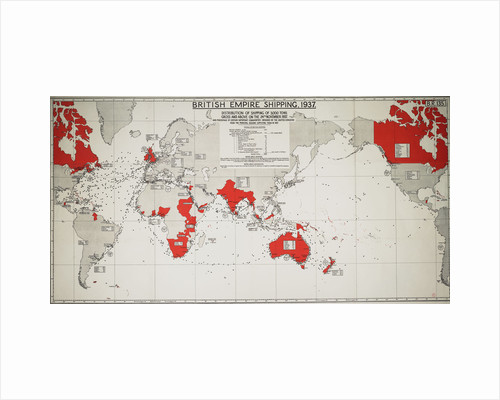
British Empire Shipping 1937
Ptolemy
Carte de l'Isle de France levee geometriquement par Mr. l'Abbe de la...
Ll'Abbe de la Caille; Lattre
Close's fisherman charts of the British Isle section 2: The North Sea
Albert Close
Le Grand Atlas, ou Cosmographie Blauiane
Joan Blaeu
Chart of London City and the river Thames
unknown
A description of the sea coastes, of the land of Algarbe, and...
Lucas Janz Waghenaer
Angliae, Scotiae, et Hiberniae, sive Britannicar: Insularum descriptio (England, Scotland and Ireland,...
Abraham Ortelius
Chart of Black Sea
Johan B. Agnese
Chart of the Island Otaheite (Tahiti) by James Cook, 1769
James Cook
Chart of the southern hemisphere, post Cook
Georg Forster
Map of the bay and city of S. Phelipe de Portobelo
Luis de Surville
Chart of Gulf of Guinea, Africa
Gerard van Keulen
Chart of Chius (Chios, Greece), 1554
Battista Agnese
Map of Northolt, Harrow and Wembley
John Rocque
Map of Virginia
John Senex
Chart of the Guinea coast, Manicongo and Angola as far as the...
A.F. van Langren
Colour map of Dominica with detailed geographical observations
Thomas Jeffereys
Chart of the North Sea and Dutch coast, 1661
Mount & Page
Portulan chart of western Mediterranean
unknown
Map of Africa
Herman Moll
A Dutch map showing areas devastated by the Great Fire of London,...
unknown
Constellation card, Urania's mirror, Chart of the Heavens for the Latitude of...
Sidney Hall
Barranca
William Hack
Humorous map of the South China Sea and Yellow Sea, 1932
unknown
Map of Bow, Stratford, Blackwall and Plaistow
John Rocque
Map of Hispaniola, 1653
Nicholas Comberford
Planesphaeri Coelestis Hemisphaerium Meridionale
Carel Allard
World map from Ptolemy's Cosmographia of 1492
Ptolemy
Plan of the environs of English Harbour, Antigua
John Brown
Part of south coast of Newfoundland including Fortune Bay
James Cook
Map of the Provence, France
Johann Baptist Homann
Map of Mottingham, Bromley and Chislehurst
John Rocque
Map of Islington, Westminster, City and Southwark
John Rocque
Map of Europe by Ortelius, 16th century
Abraham Ortelius
Map of Amsterdam with inset view
Carel Allardt
« Previous
1
2
3
4
Next »
Recently viewed
Clear history