Skip to main content
10% off your first order
☰ Menu
Basket icon
Wishlist icon
Account icon
Search icon
Search icon
Inspiration
Collections
Astrophotography
Battles and wars at sea
Children's
Exploration
Graphic designs
Greenwich
Historic figures
Historic vessels
Maps and charts
Photography
Pirates
Seascapes
Time and space
Natural history
World travel
Ship plans
Gift cards
Contact
Contact us
Newsletter
Search art & photography
Search icon
Home
Collections
Maps and charts
Maps and charts
page 12
Showing 529 to 576 of 917
Featured
A-Z
Z-A
Oldest to newest
Newest to oldest
Bestselling
Products
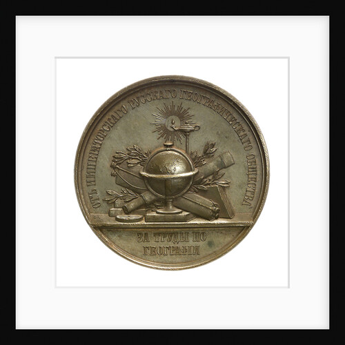
Medal commemorating Admiral Count Lutke; reverse
B.V. Alexejeff
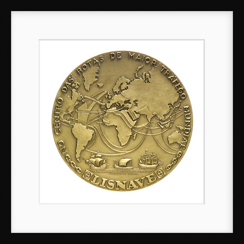
Medal commemorating the opening of the Lisbon dry dock, 1967; reverse
Leopoldo de Almeida
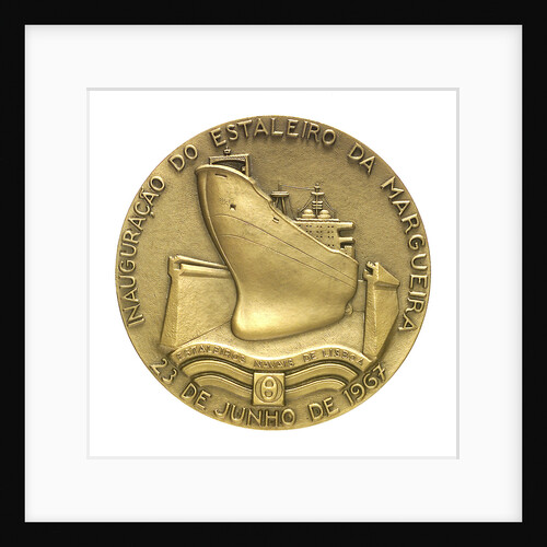
Medal commemorating the opening of the Lisbon dry dock, 1967; obverse
Leopoldo de Almeida
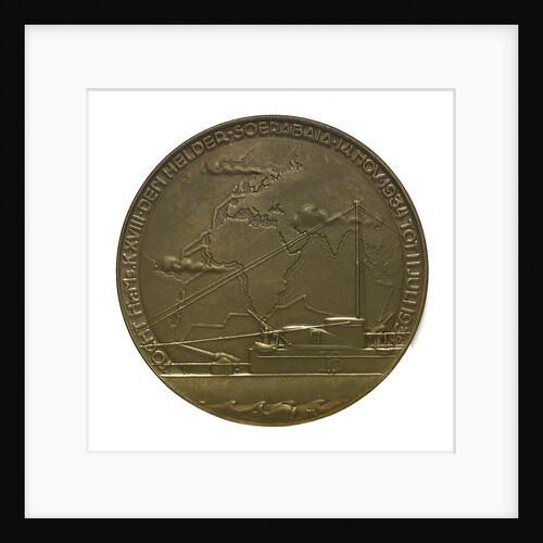
Medal commemorating the voyage of the submarine 'K. XVIII'; obverse
M. Kutterink
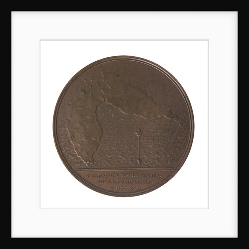
Medal commemorating the defence of Guadeloupe, 1721; reverse
J. Duvivier
Medal commemorating eight hundred naval cadets enrolled for service in the war navy; obverse
L.I.
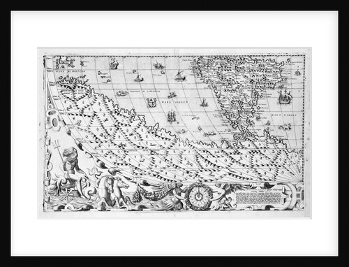
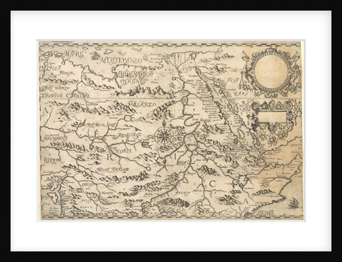
Section plate from Francesco Camocio's 'Cosmographia Universalis', 1567, taken from the atlas 'Tavole Moderne di Geografia'
unknown
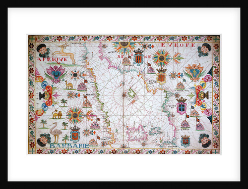
Chart of the western Mediterrean showing the north African and Spanish coasts, 17th century
Cavolini
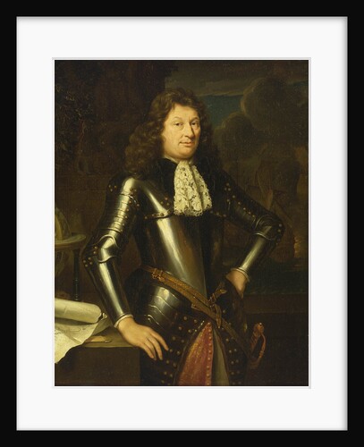
Portrait of a naval officer
unknown
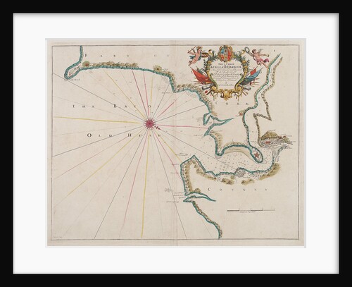
New York harbour
J.F.W. Des Barres
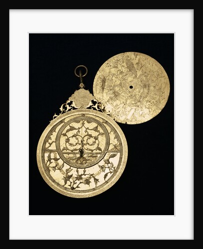
Astrolabe: obverse and plate
Muhammad Mahdi al-Yazdi
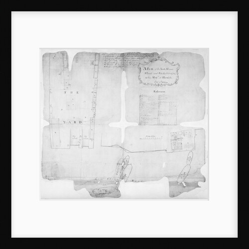
Harwich Dockyard
Harwich Dockyard
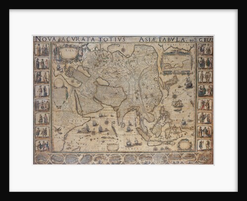
Nova & Acurata Totius Asiae Tabula, auct G. Blaeu
unknown
Gillingham and Cookham Bloods, River Medway
Bernard de Gomme
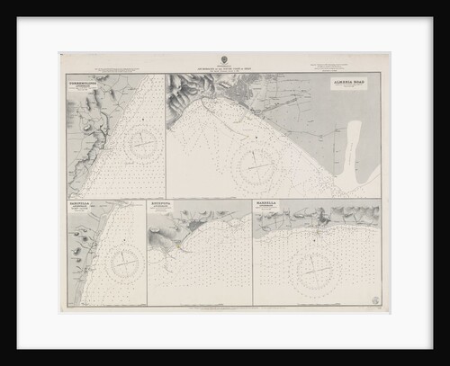
Mediterranean anchorages on the south coast of Spain from Spanish Government surveys of 1891
British Admiralty
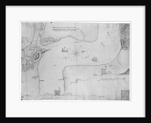
Map of Kingsale Harbour
F. Harris
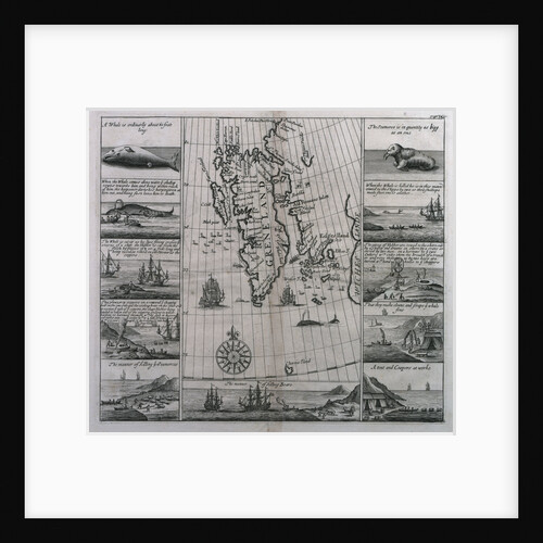
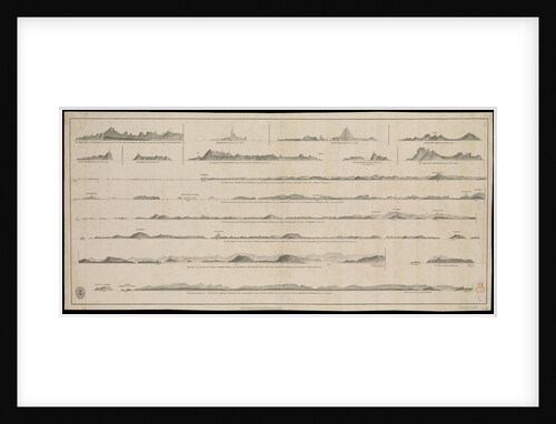
Greenland, showing map and eleven views
unknown
Map of the Congo Kingdom 1578
unknown
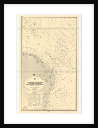
Orford Ness to Blakeney with the off lying shoals between Smiths Knoll and the other Dowsing
British Admiralty
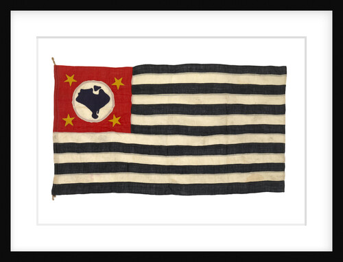
Regional flag, Sao Paulo
unknown
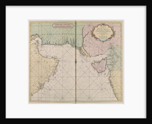
Map of Arabia, Persia, Gijarat and Decca
J. van Keulen
River approach to Surat
Valentyn & van Keulen
Views of Gujarat coast (lie of the land)
British Admiralty
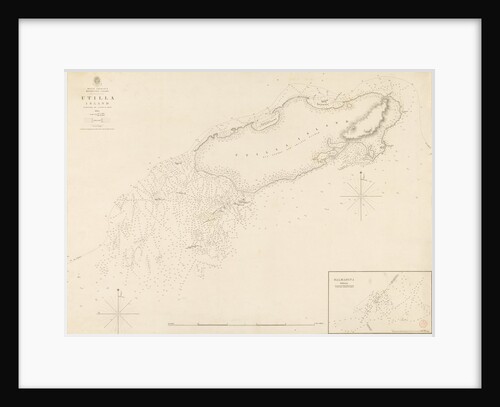
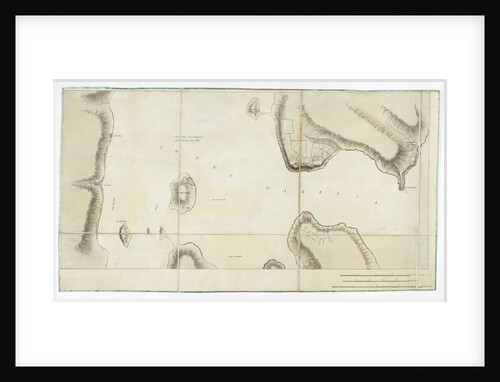
West Indies Mosquito Coast Utilla Island surveyed by Commander R. Owen 1835
British Admiralty
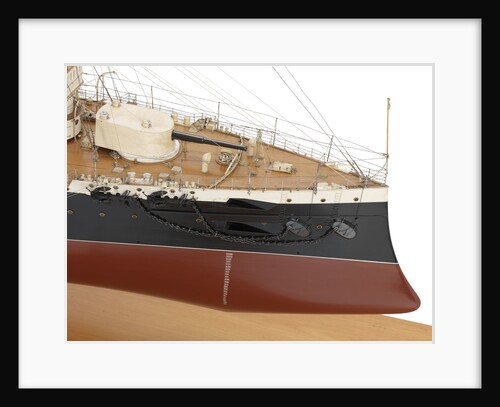
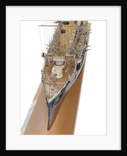
HMS 'Leviathan' (1901)
John Brown & Co. Ltd
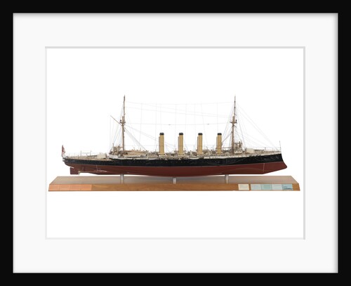
HMS 'Leviathan' (1901)
John Brown & Co. Ltd
HMS 'Leviathan' (1901)
John Brown & Co. Ltd
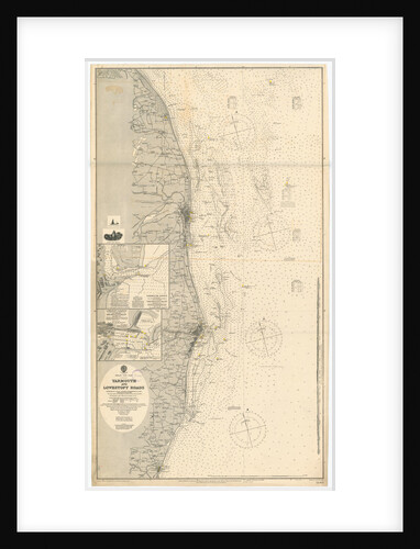
Yarmouth and Lowestoft
British Admiralty
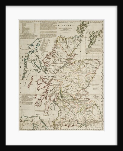
A commercial map of Scotland with the roads, stages and distances
J. Knox
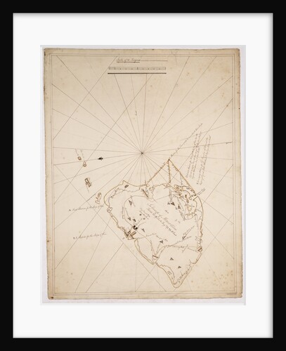
Island of Mauritius
James Campbell
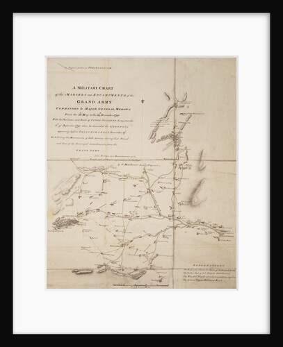
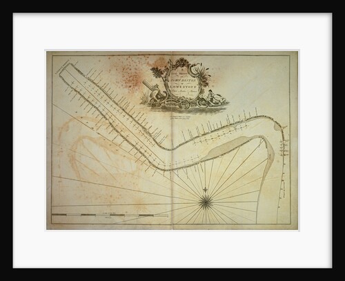
A military chart of the marches and encampments of the grand army commanded by Major General Medows from the 26th...
C. Mackenzie
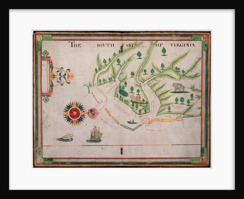
The south part of Virginia, 1657
Nicholas Comberford
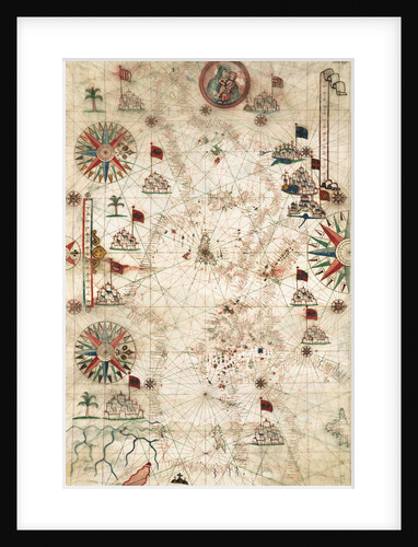
Chart of Mediterranean Sea, with part of the Black Sea
Placido Caloiro y Oliva
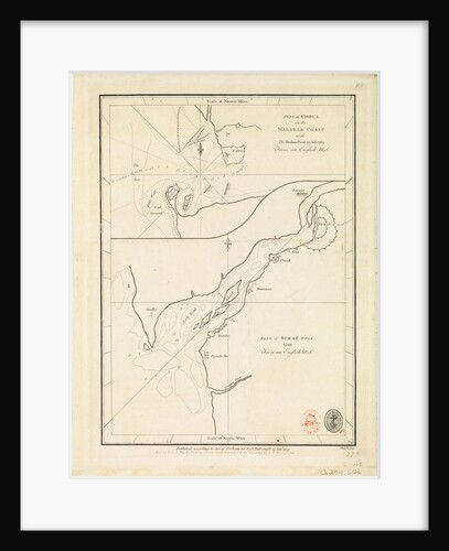
Chart of Cork harbour, Ireland
unknown
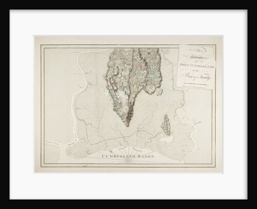
The environs of Fort Cumberland in the Bay of Fundy
J.F.W. Des Barres
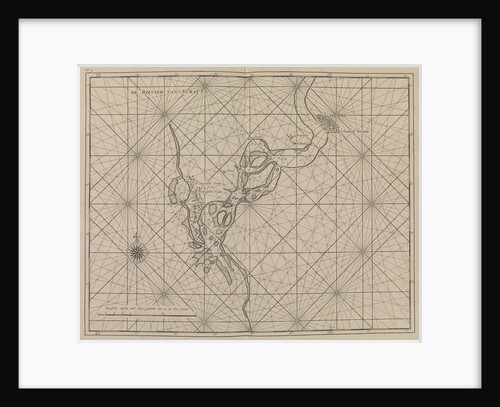
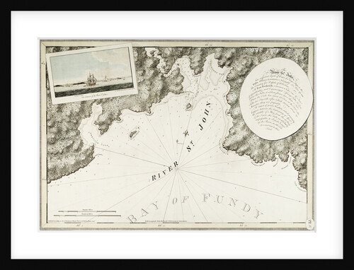
The River St. John
J. F. W. Des Barres
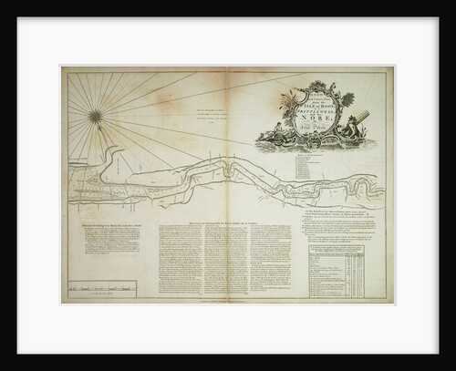
A new and correct chart from the Isle of Dogs, to Prittlewell, and the Nore
John Diston
River Thames from London Bridge to the Isle of Dogs. A late survey by John Diston of Lowestoff, pilot, master...
John Diston
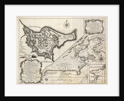
A plan of the city and harbour of Louisburg, Cape Breton
J. Hinton
A new & exact map of the island of Barbados in America according to survey made in the years 1717...
William Mayo
A new & exact map of the island of Barbados in America according to survey made in the years 1717...
William Mayo
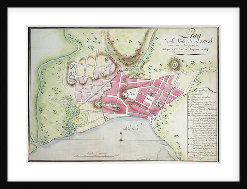
Plan of Jacmel town with fortifications
Sorrel
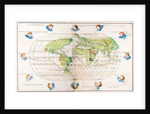
Oval planisphere of the world showing Magellan's track, 1554
Battista Agnese
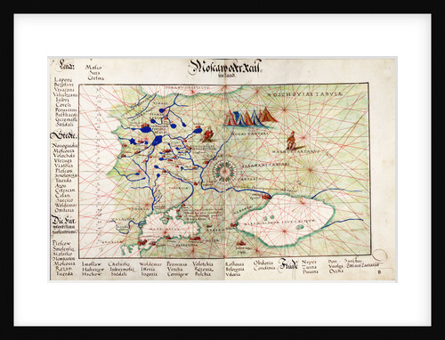
Chart of Moscow and the Black Sea
Johan B. Agnese
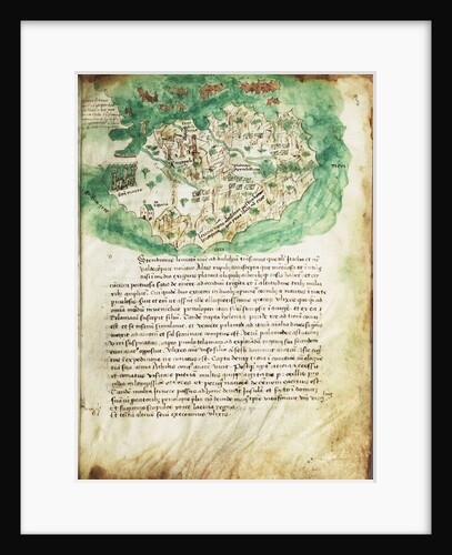
Chart of Paxos
Cristoforo Buondelmonti
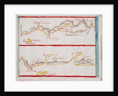
Arauco
Basil Ringrose
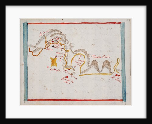
Concepcion
Basil Ringrose
Plan of Choul and Surat River, 1775
unknown
« Previous
1
…
10
11
12
13
14
…
20
Next »
Recently viewed
Clear history